National Geographic Society
The Massif of Mt. Hubbard, Mt. Alverstone, and Mt. Kennedy
1968
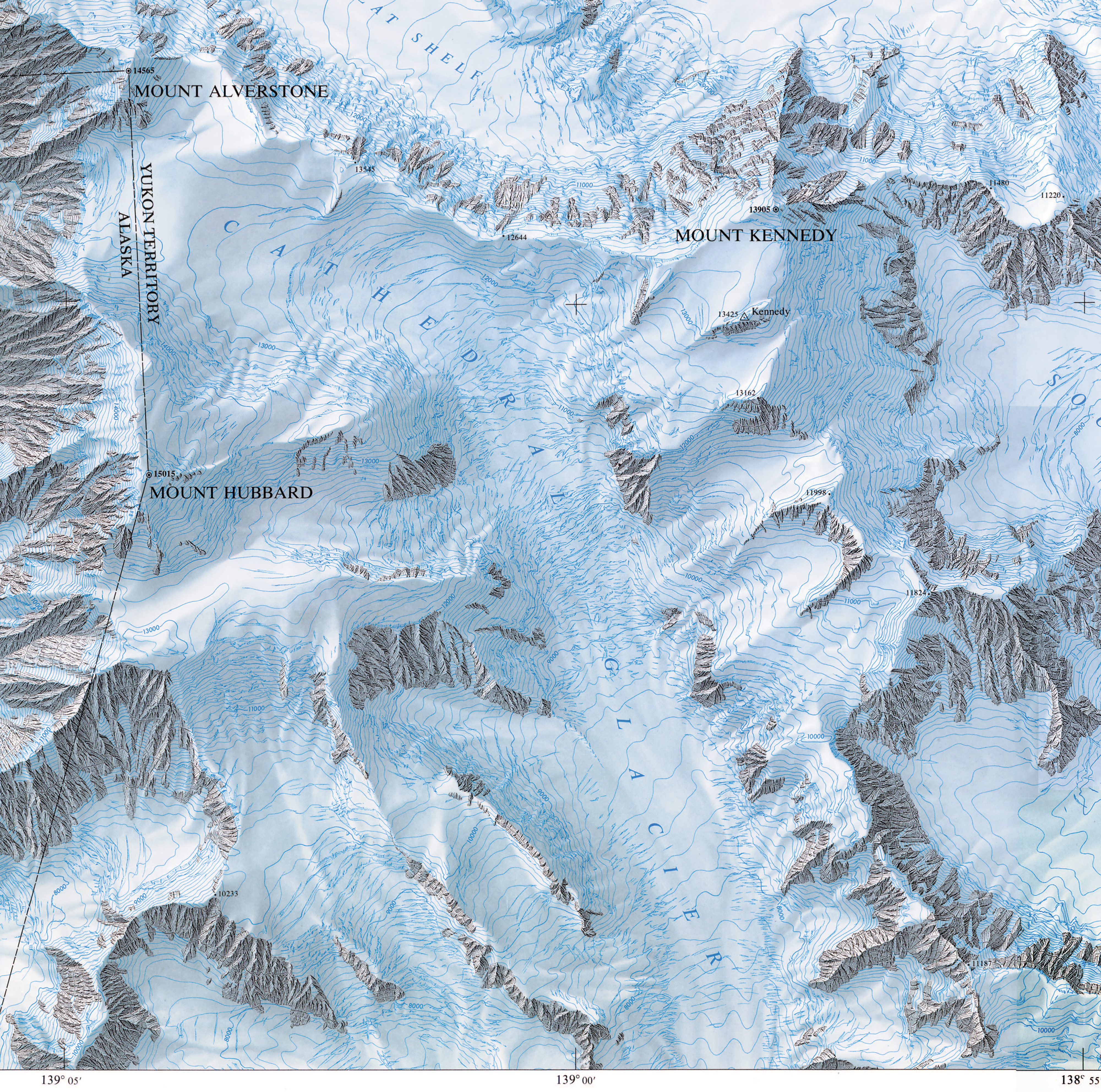
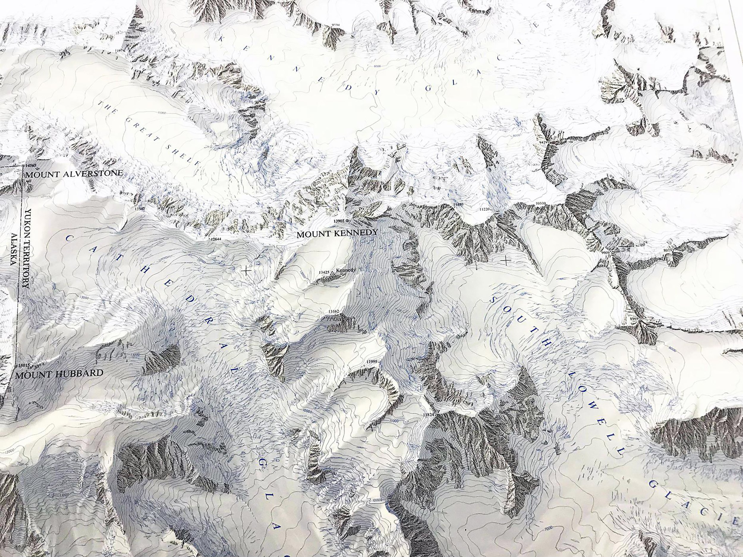
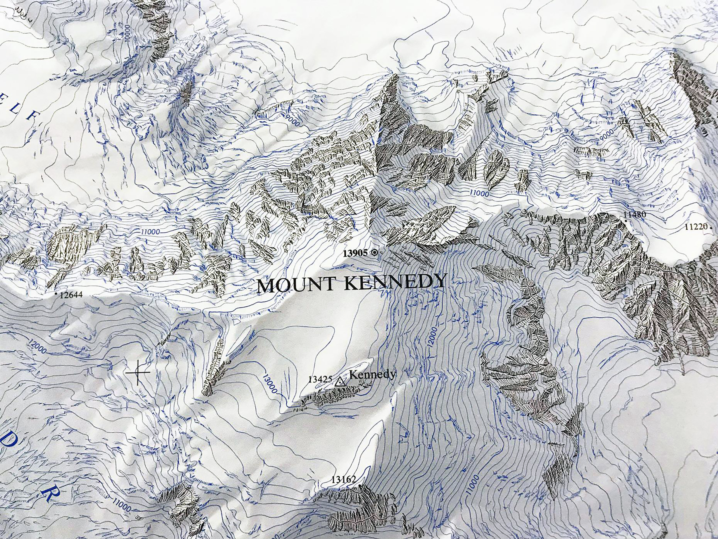
Part of the Massif of Mount Hubbard, Mount Alverstone, and Mount Kennedy map, Yukon Territory, showing the highly glacierized terrain, including the source of the Hubbard and Lowell Glaciers. Map project directed by Bradford Washburn, Honorary Director, Boston Museum of Science. Field survey directed by Gottfried Konecny, photogrammetric compilation by Gerhard Gloss. Rocks and contours drawn by Paul Ulmer and relief shading by Tibor G. Toth.
60°18'49.8"N 139°04'07.3"W
Lieu: Yukon, Canada
Publié: Octobre 2019
Catégorie: Cartographie
Source
Lieu: Yukon, Canada
Scale: 1:31’680
Collection: Bradford Washburn - NGS
Publié: Octobre 2019
Catégorie: Cartographie
Source