USGS
South Florida
1993
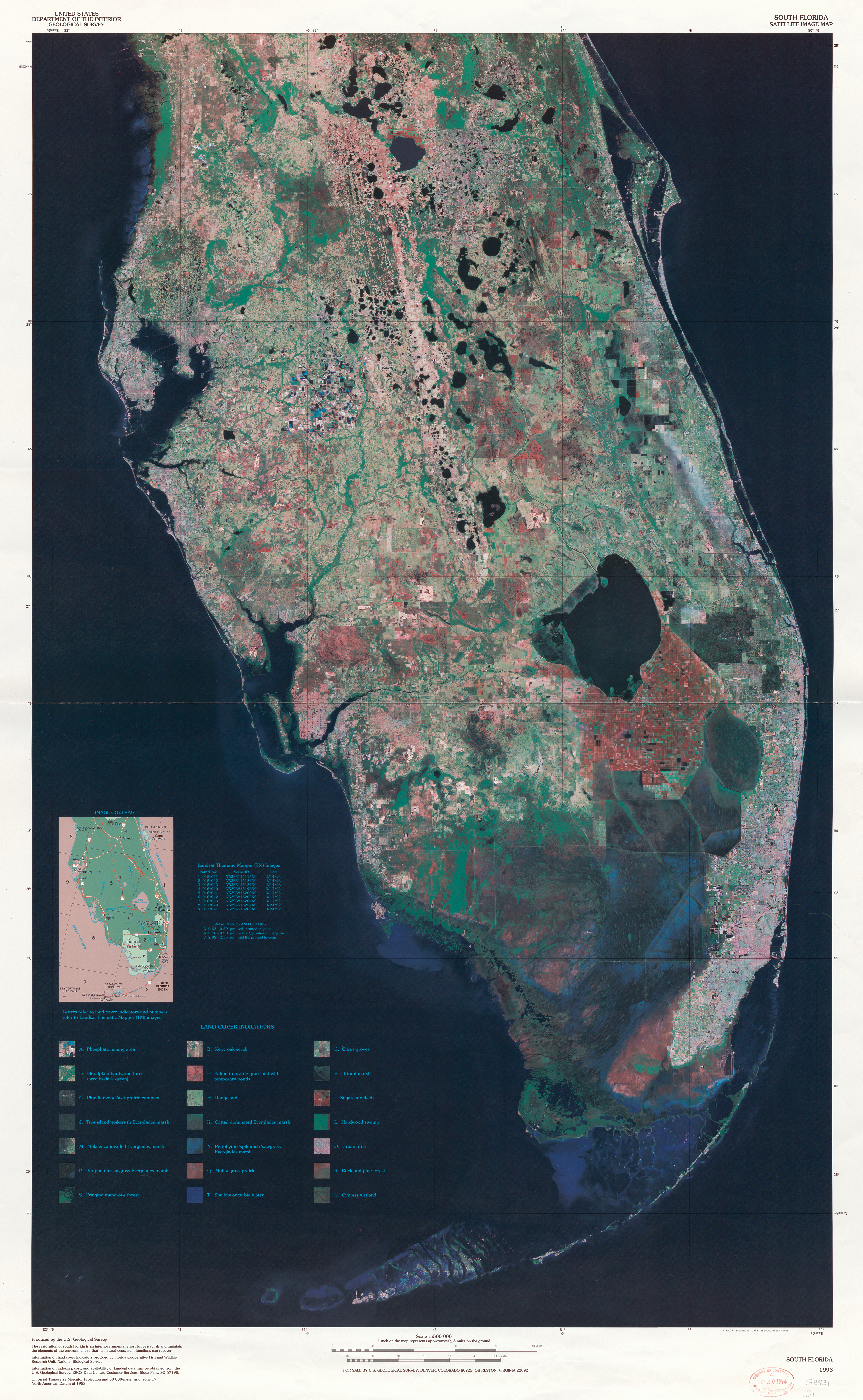
Provides land cover indicators for various kinds of biotic communities identified by characteristic vegetation and for citrus groves, sugarcane fields, urban areas, and phosphate mining areas. Information on land cover indicators provided by Florida Cooperative Fish and Wildlife Research Unit, National Biological Service. Includes map showing image coverage and table of information on Landsat Thematic Mapper (TM) images.
28°06'00.0"N 81°36'00.0"W
Lieu: Florida, USA
Publié: Janvier 2019
Catégorie: Cartographie
Lieu: Florida, USA
Publisher: Reston, Va. (The Survey, 1995)
Size: 102 x 63 cm
Collection: Library of Congress Geography and Map Division
Publié: Janvier 2019
Catégorie: Cartographie