USGS
Oblique Maps of the North Pacific Ocean
1972–1980
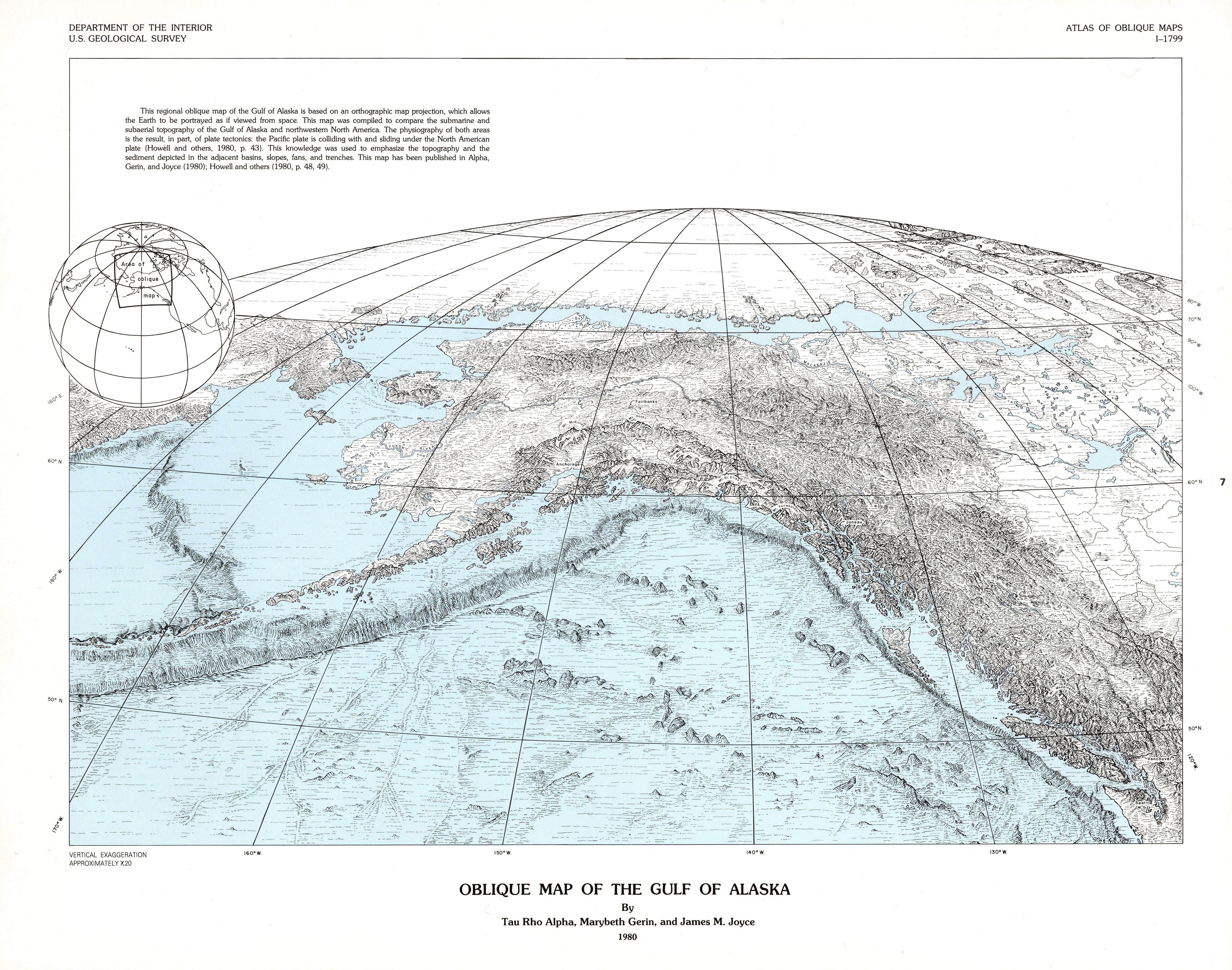
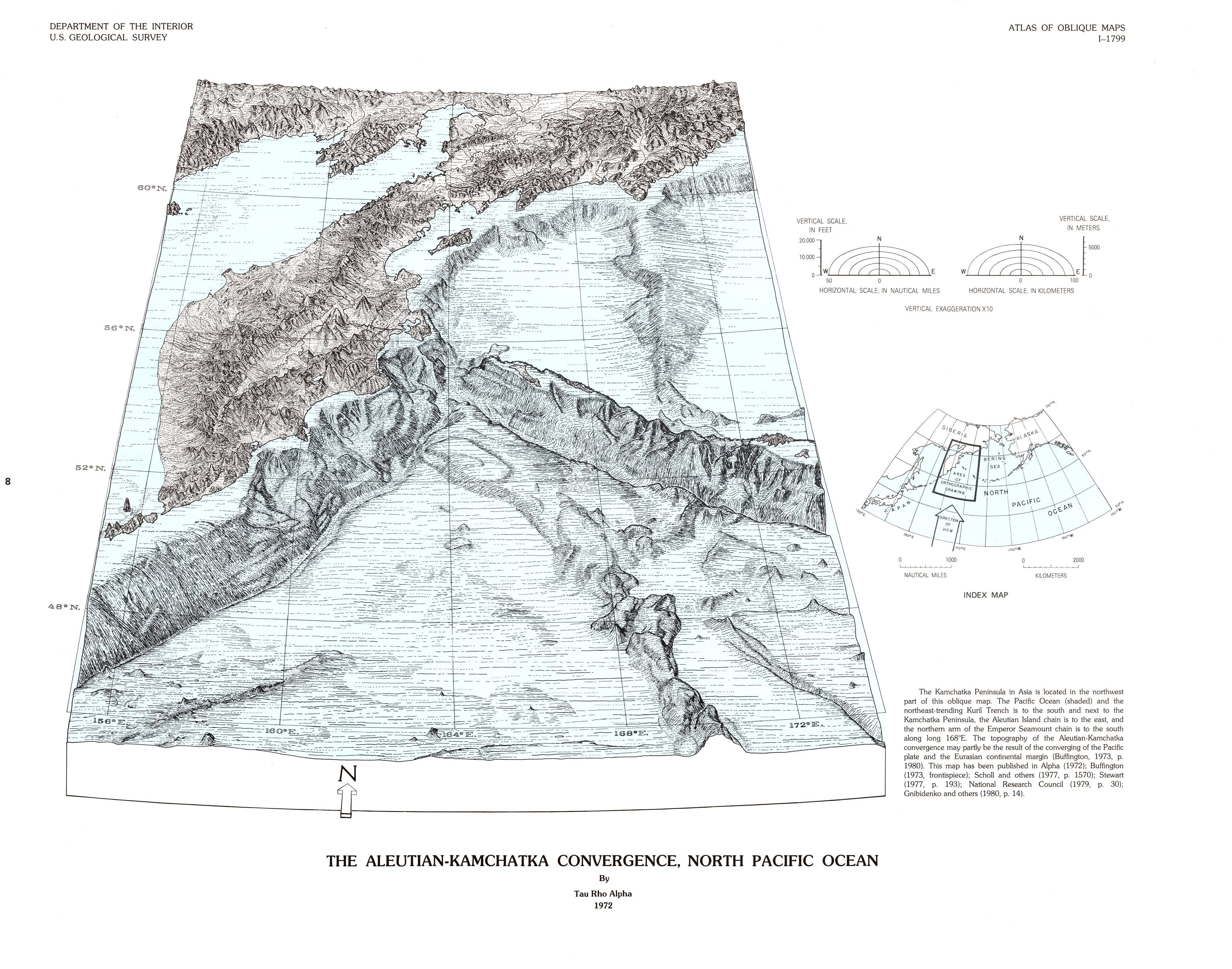
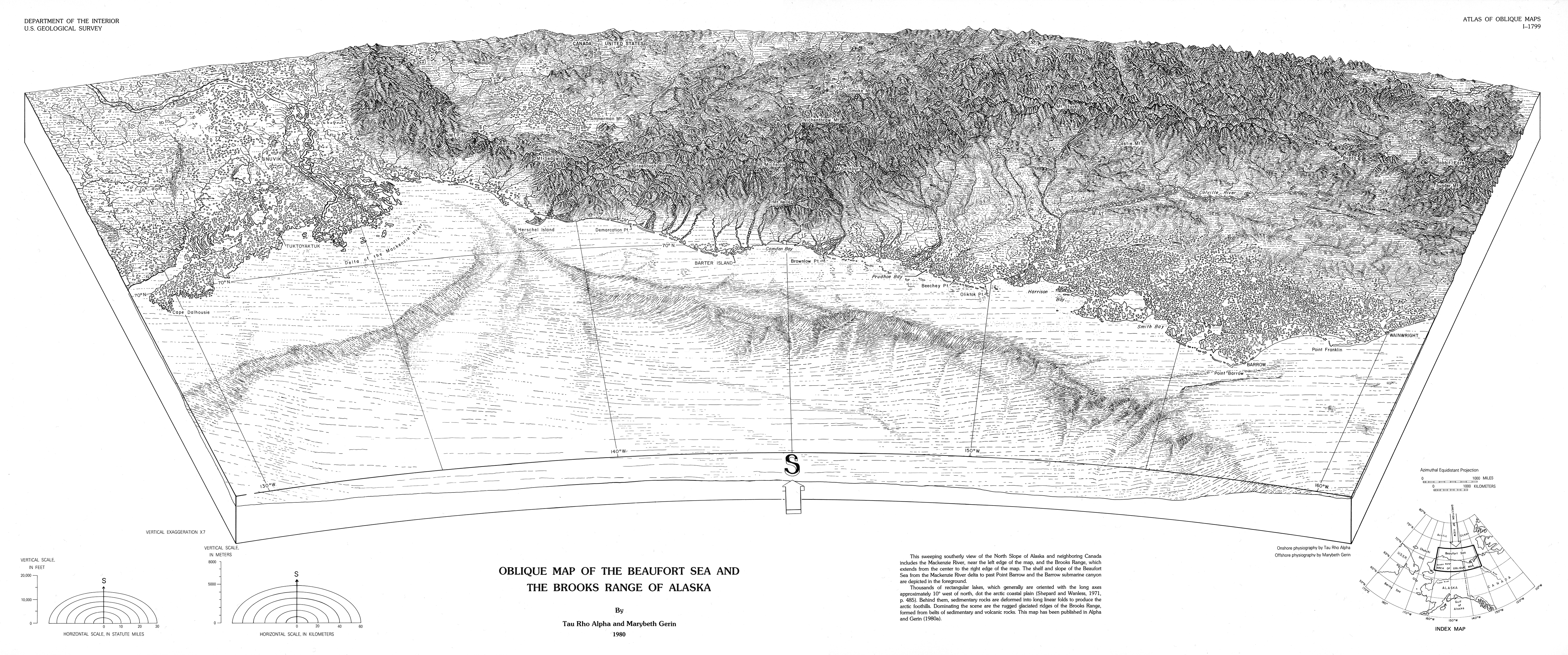
This folio comprises scale-accurate, obliquely viewed maps compiled from 1961–1986 that portray the physiography of selected areas of the ocean floor and continents around the world. These oblique views of landscapes draw upon the techniques of Armin K. Lobeck, Erwin J. Raisz, and Philip B. King. USGS Miscellaneous Investigations Series I-1799.
0°00'00.0"N 160°00'00.0"W
Lieu: Pacific Ocean
Publié: Décembre 2018
Catégorie: Cartographie
Lieu: Pacific Ocean
Authors: Tau Rho Alpha - Marybeth Gerin - James M. Joyce
Collection: David Rumsey Map Collection
Publié: Décembre 2018
Catégorie: Cartographie