NGS
Mississippi River Flood
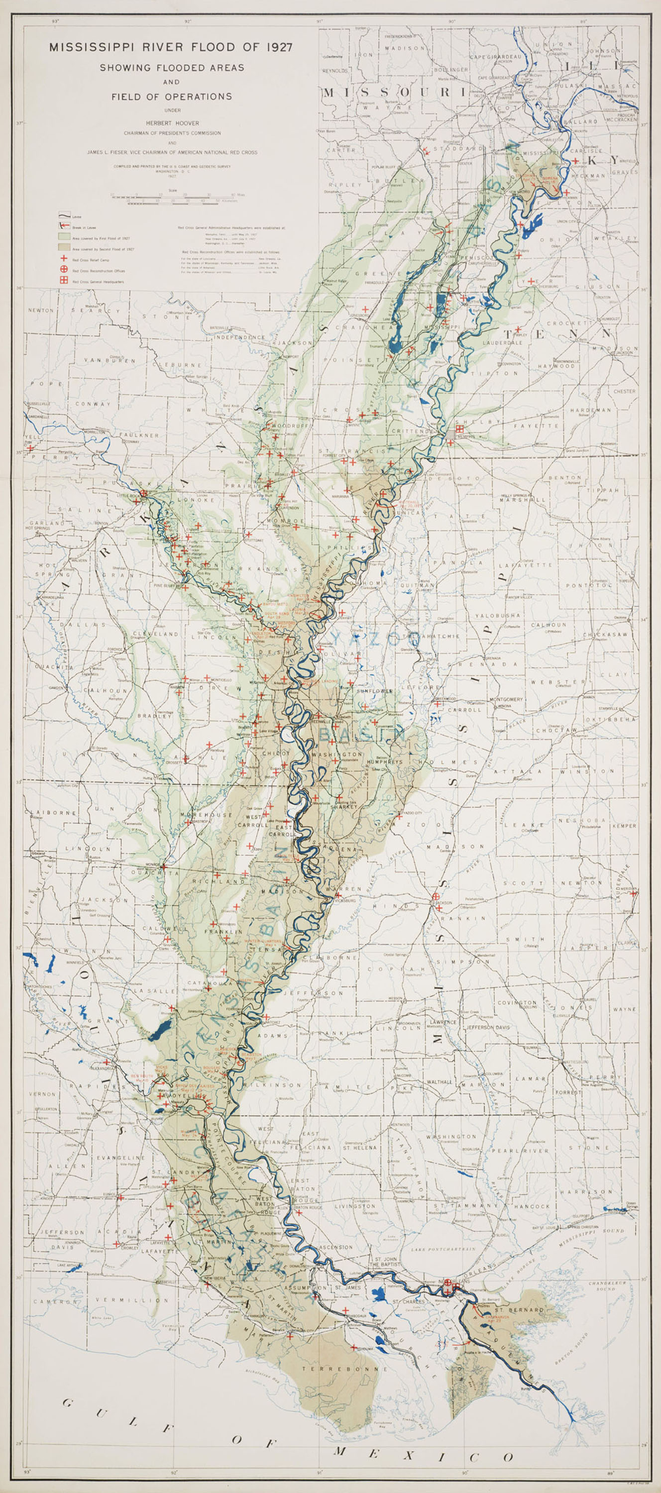
1927
The Survey acquired new responsibilities as technologies changed, but it retained old responsibilities as well. Since the Mississippi River Commission was founded in 1879, a high-ranking officer of the Survey had always been a member. In 1927 a disastrous flood on the Mississippi River wreaked damage and suffering on a scale that was unparalleled in modern American life. Herbert Hoover chaired a commission to investigate the flood and its causes, a role whose success sent him to the White House. The commission asked the Coast and Geodetic Survey to analyze the floods and map them. The resulting map, which shows how levees were deliberately dynamited to flood the bayous and spare the city of New Orleans, contains a graphic drama unmatched until the era of NOAA’s maps of the damage caused by Hurricane Katrina.
Lieu: Mississippi River, USA
Commission: Herbert Hoover - James L. Fieser
Publisher: Western Illinois Universities
Collection: Records of the Coast and Geodetic Survey, RG 23
Text: John Cloud, The 200th Anniversary of the Survey of the Coast, 2007
Publié: Août 2018
Catégorie: Cartographie