LPI
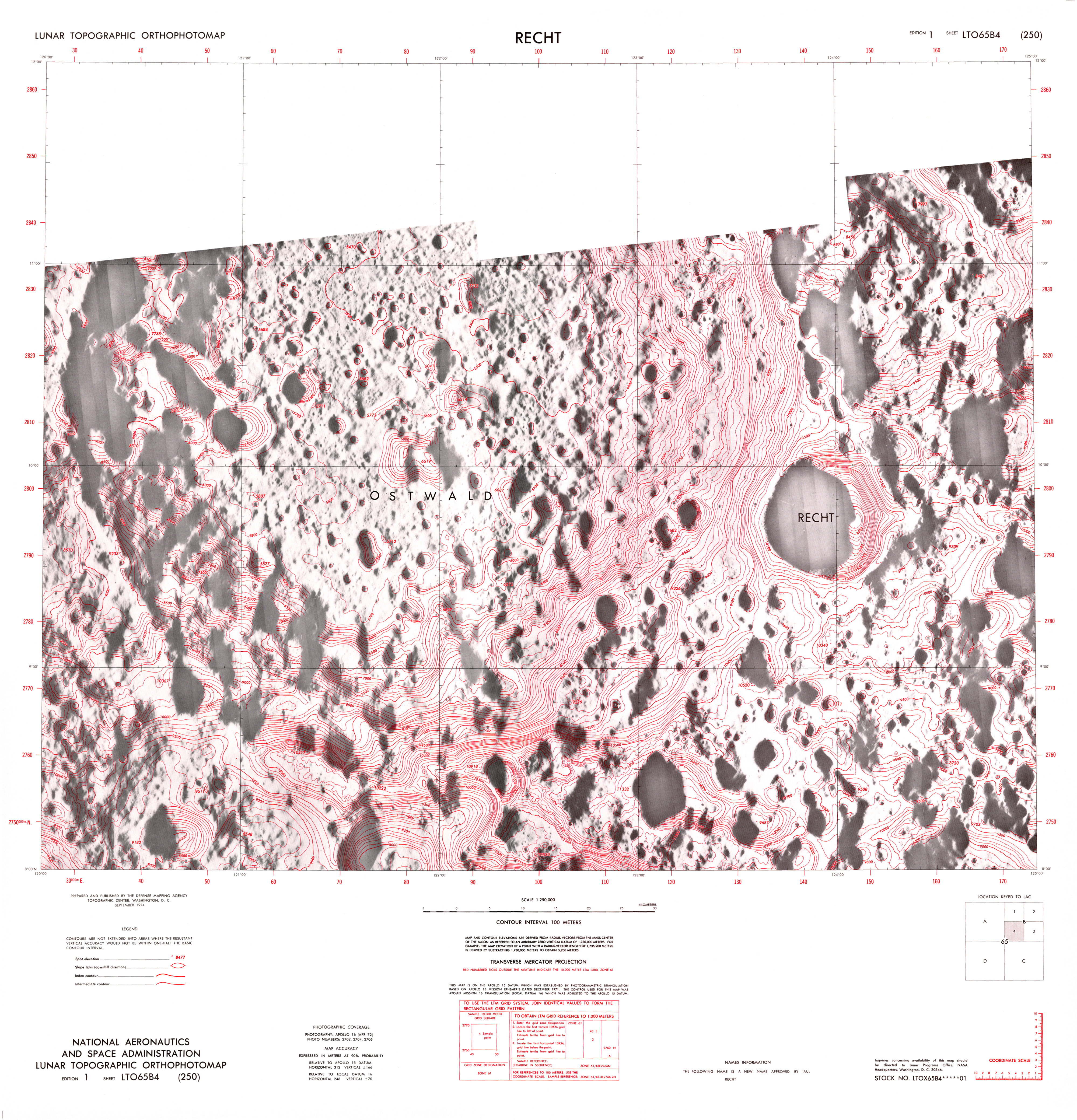
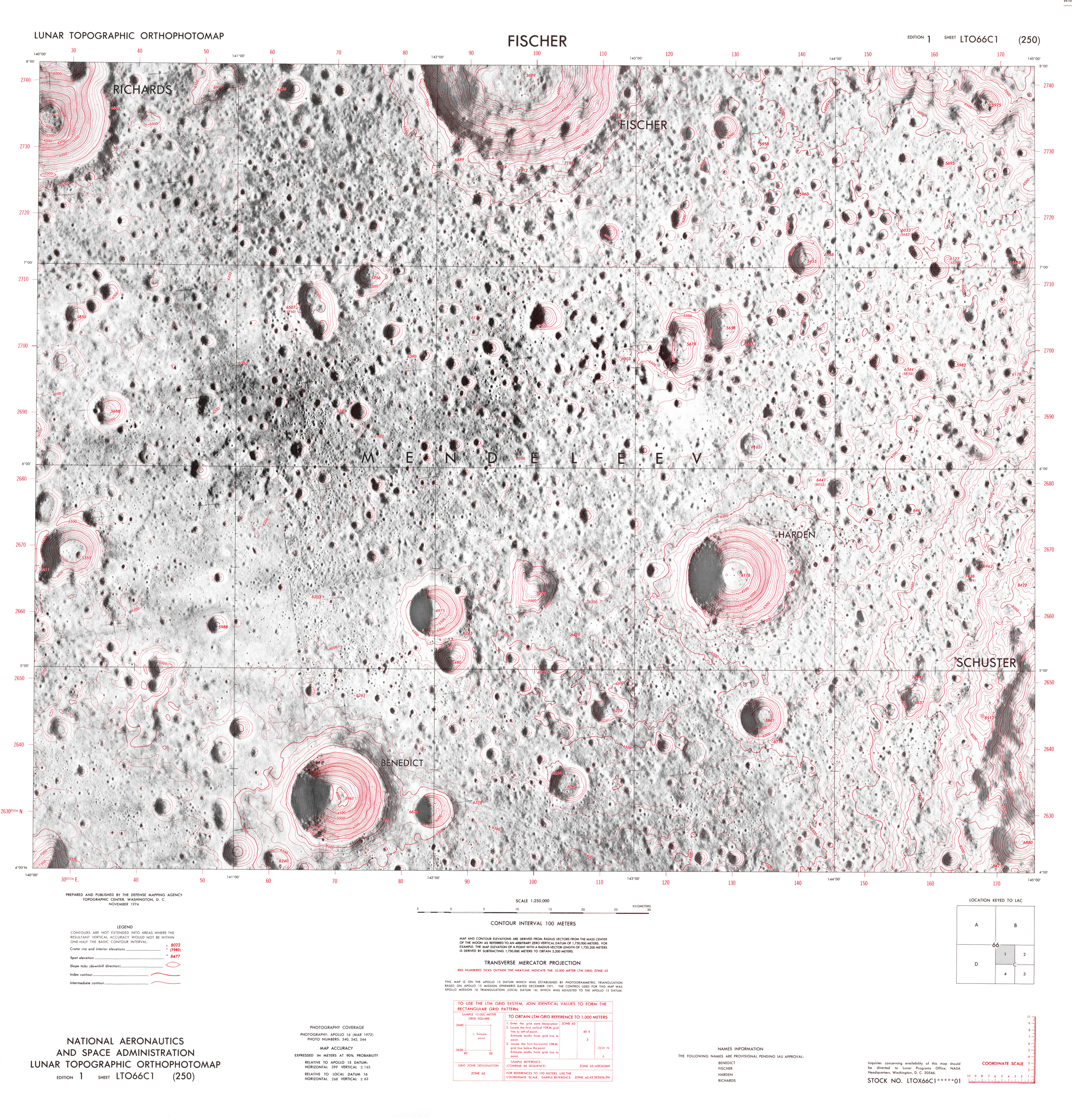
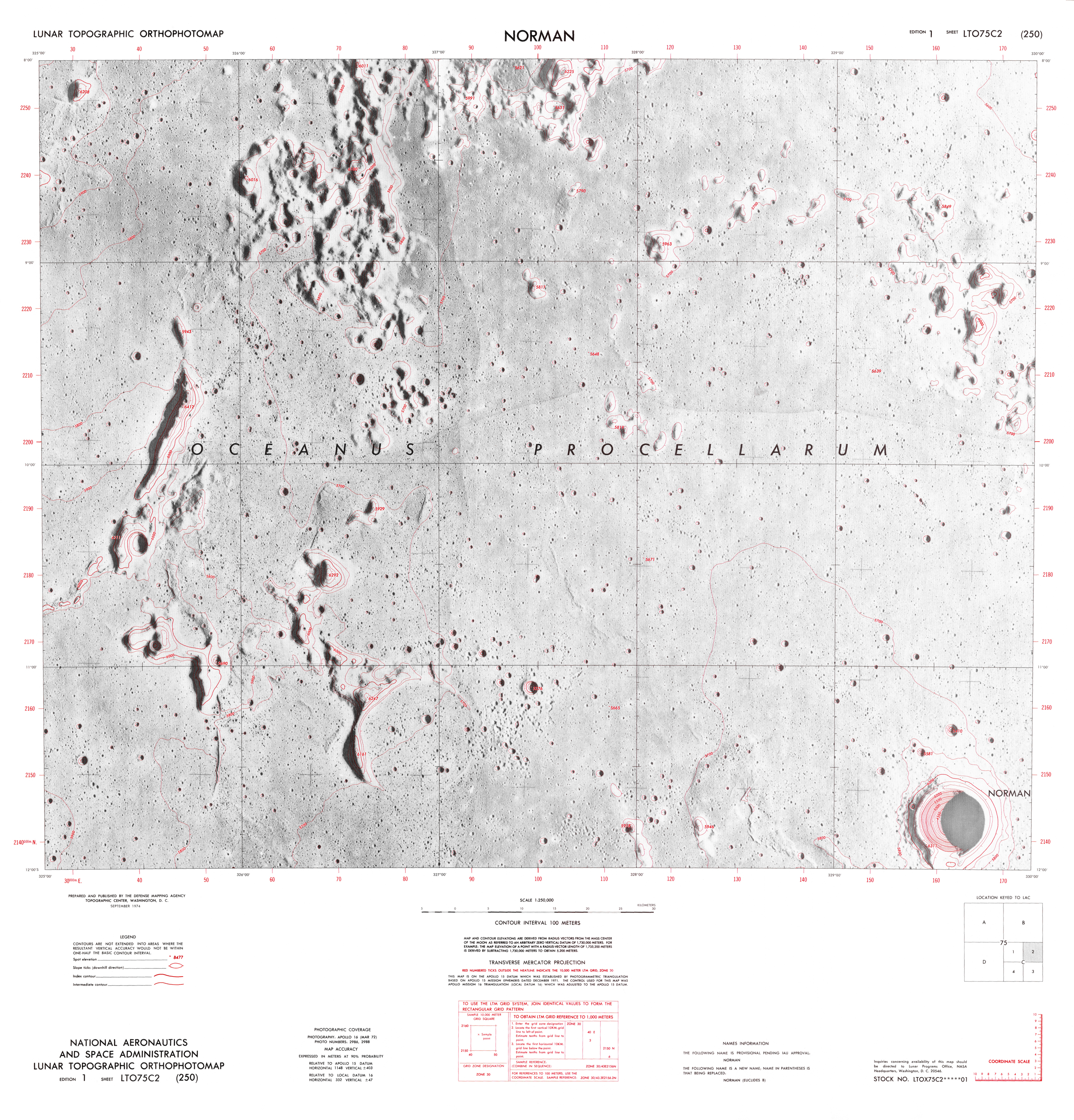
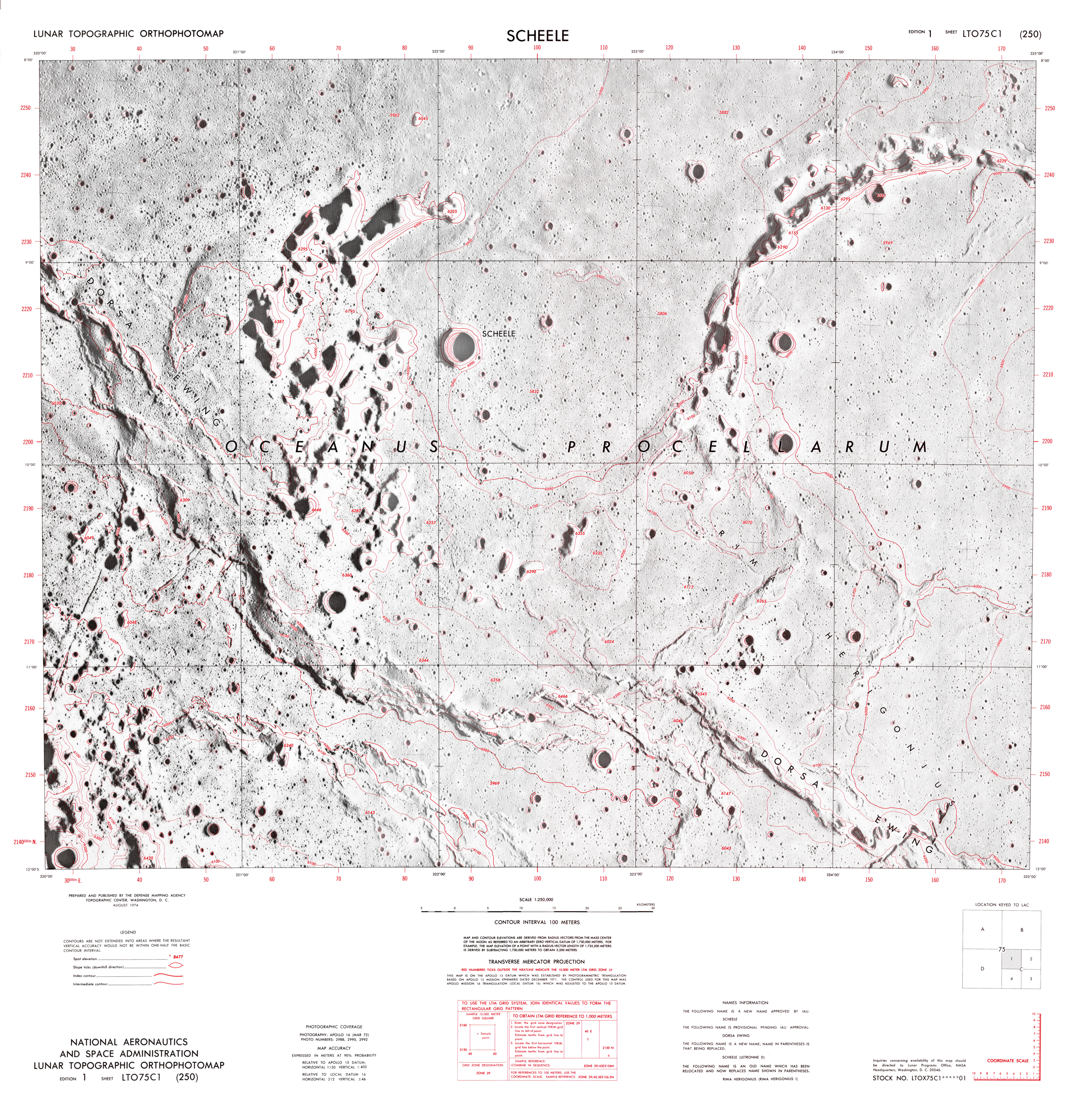
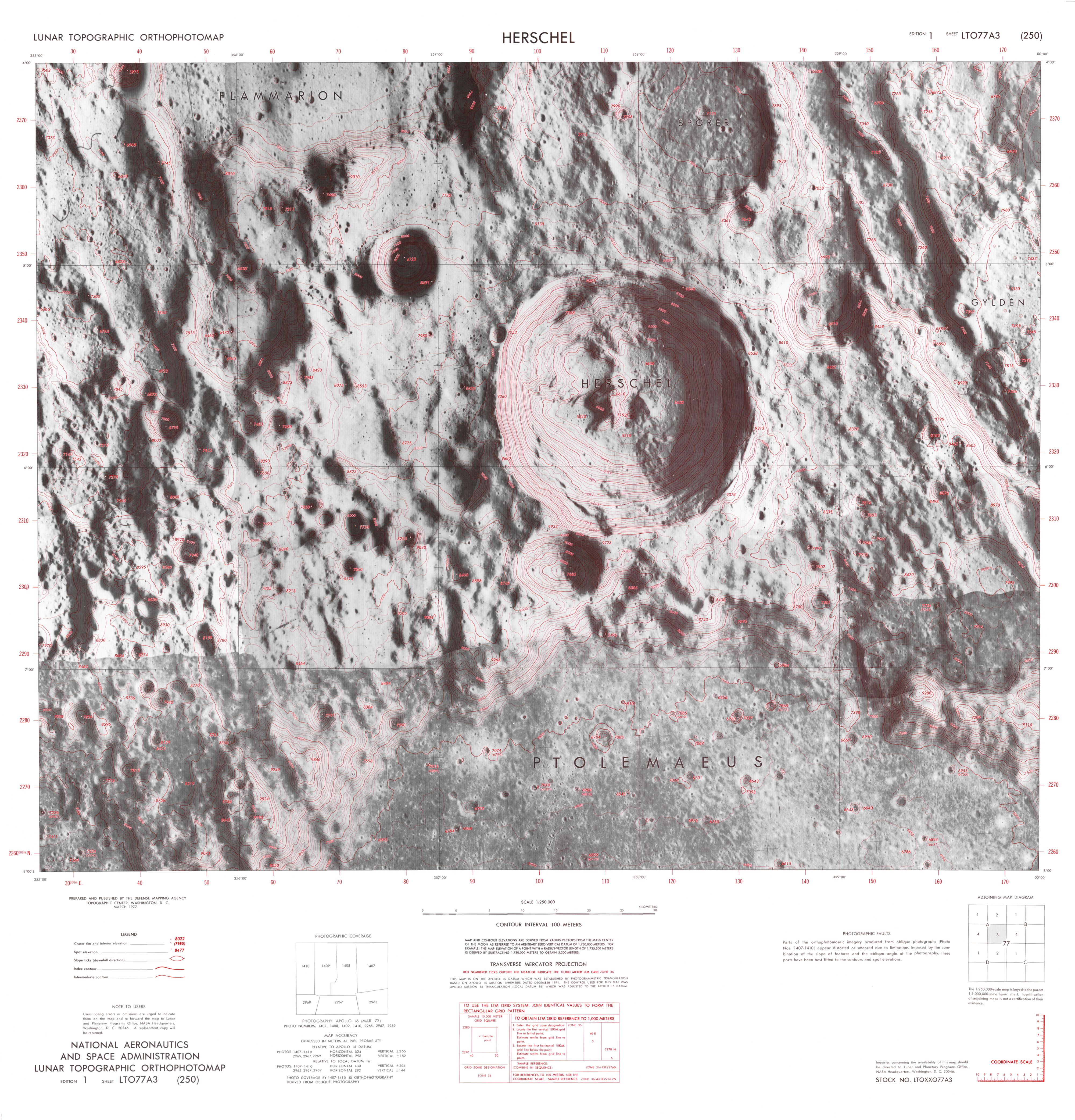
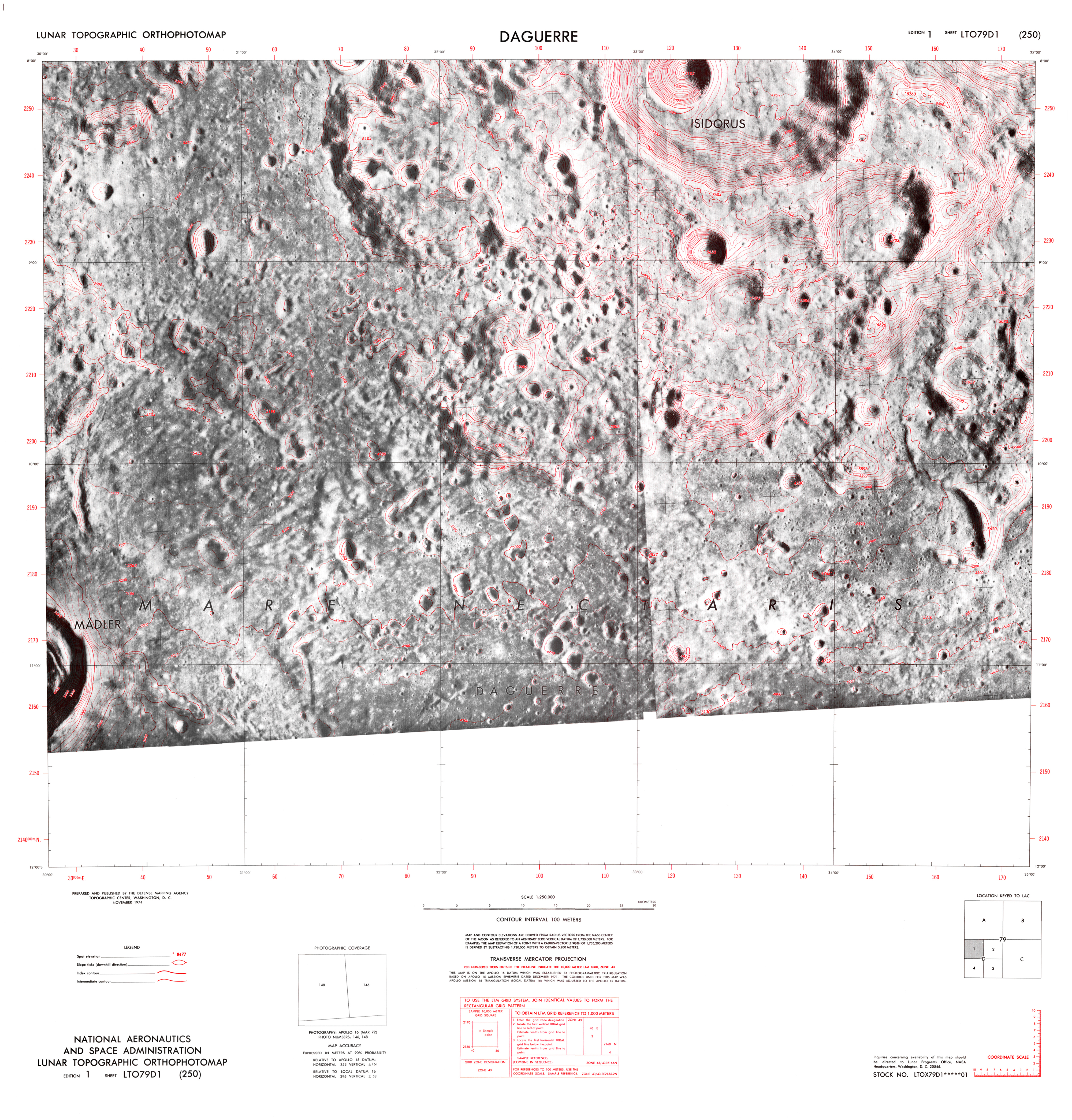
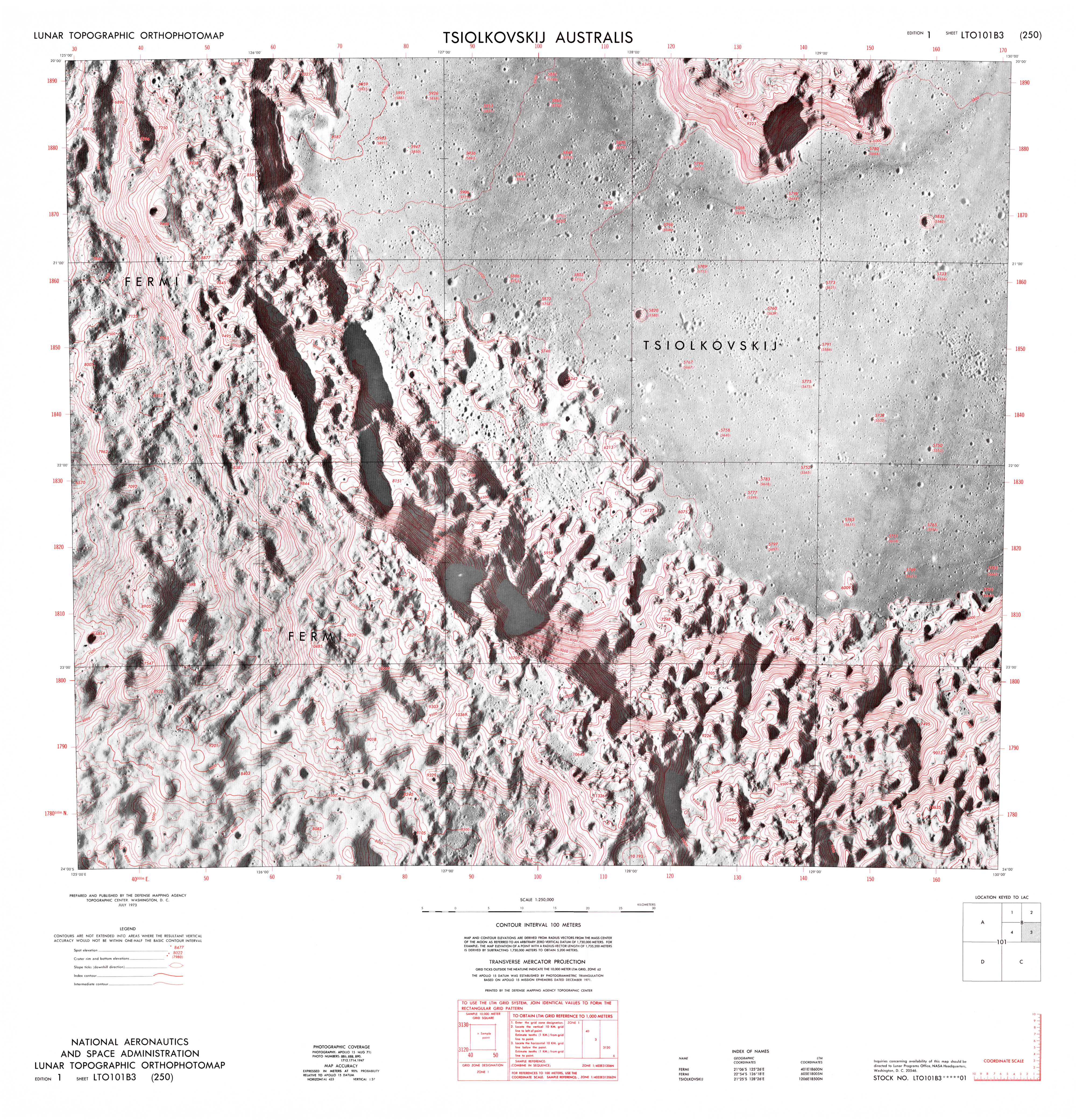
Lunar Topographic Orthophotomap
1973
Throughout man’s history on earth he has sought to explore the outer reaches of his environment and to map his findings. His first cartographic efforts have recorded the minimal topographic information necessary to insure group survival and cartographic progress has gradually developed in conjuction with increased ability to function in new regions. His earthbased view of the moon similarly progressed from the fanciful to an ordered science limited only by earth-moon distance and geometric relationship.
In less than a decade, lunar exploration and corollary mapping have progressed to the vantage point of lunar proximity, thereby yielding the first description of the lunar farside and enabling man’s personal exploration of the moon’s surface.


Author: Lunar and Planetary Institute
Publisher: Defense Mapping Agency
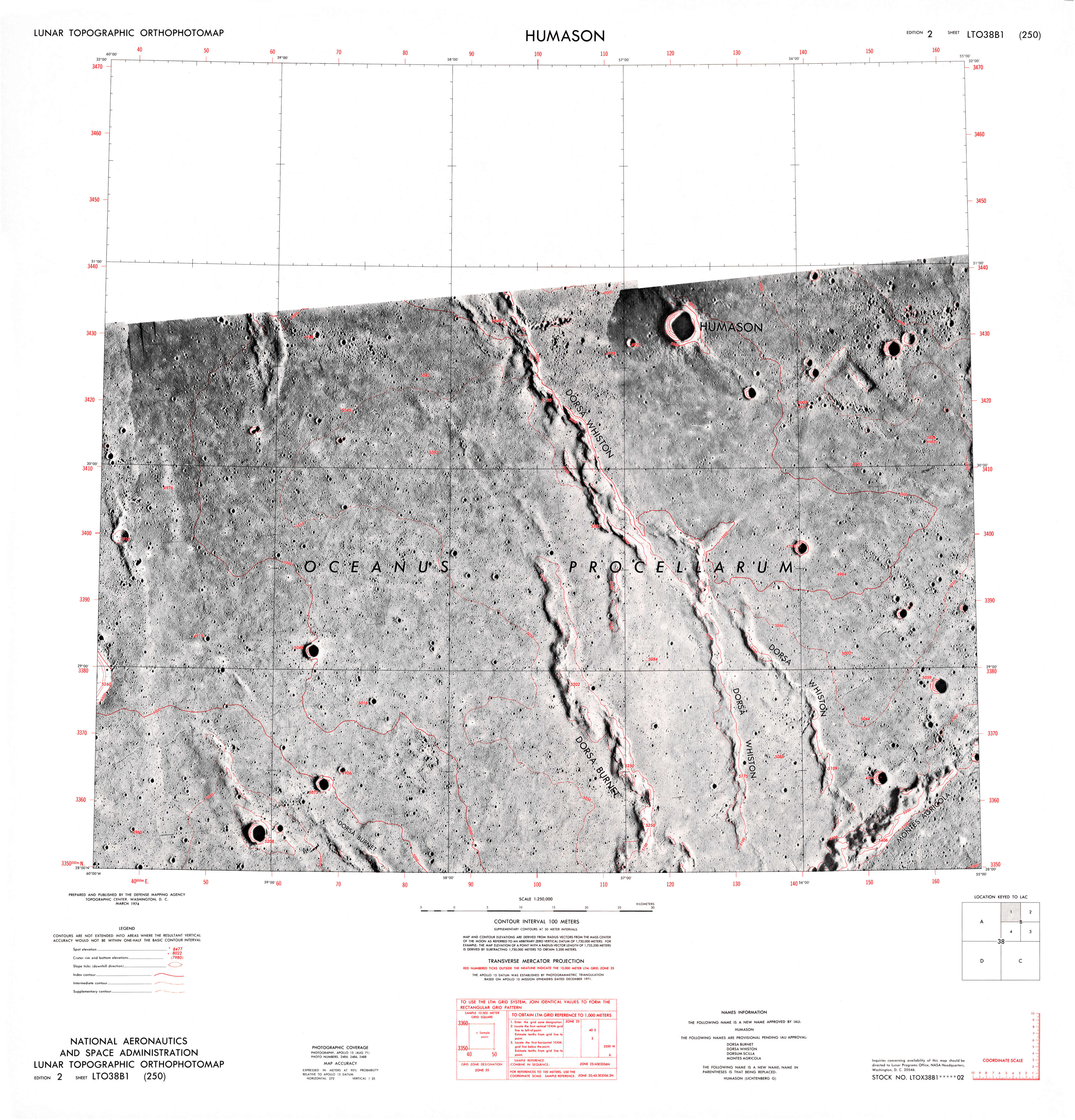
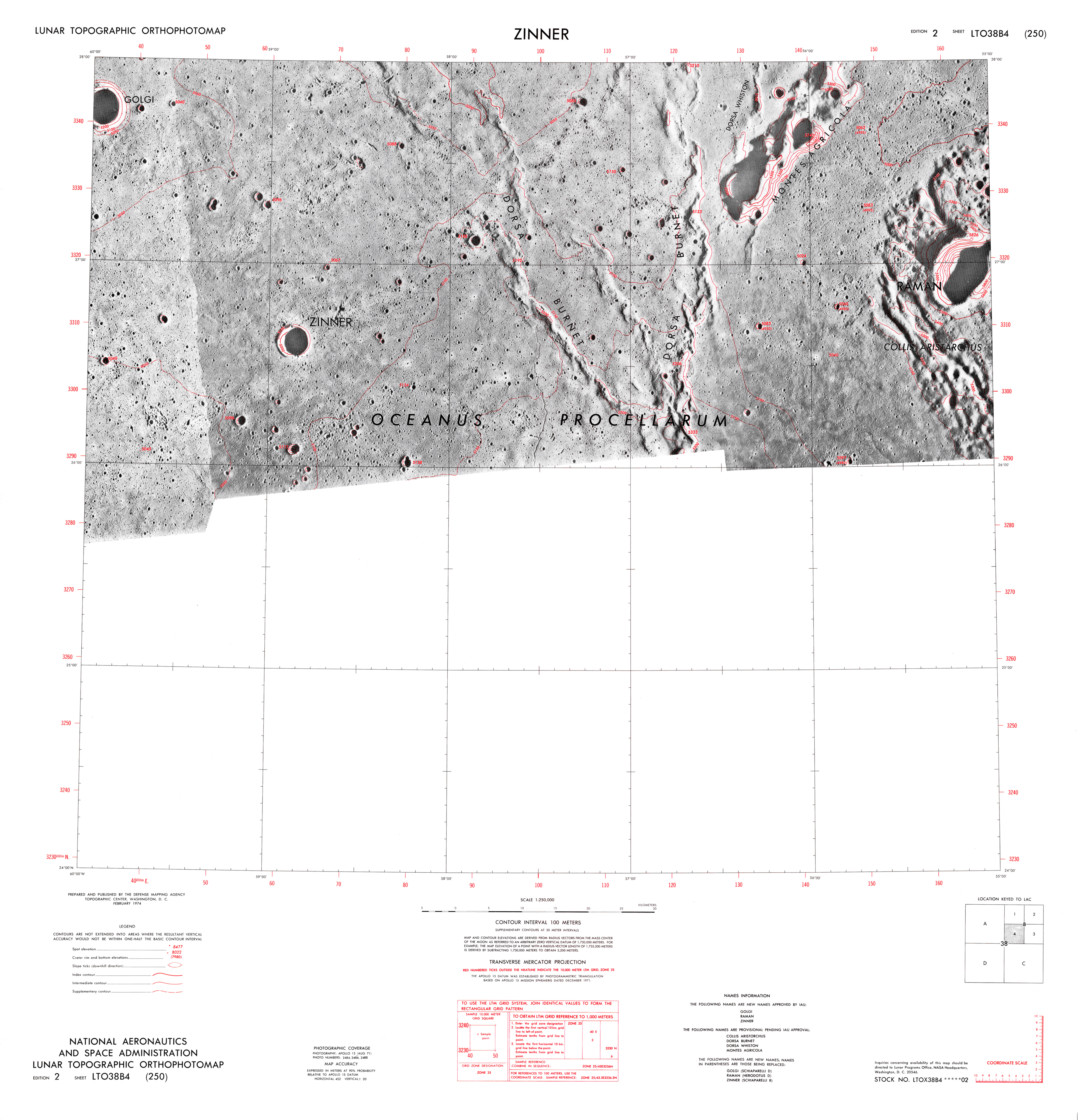
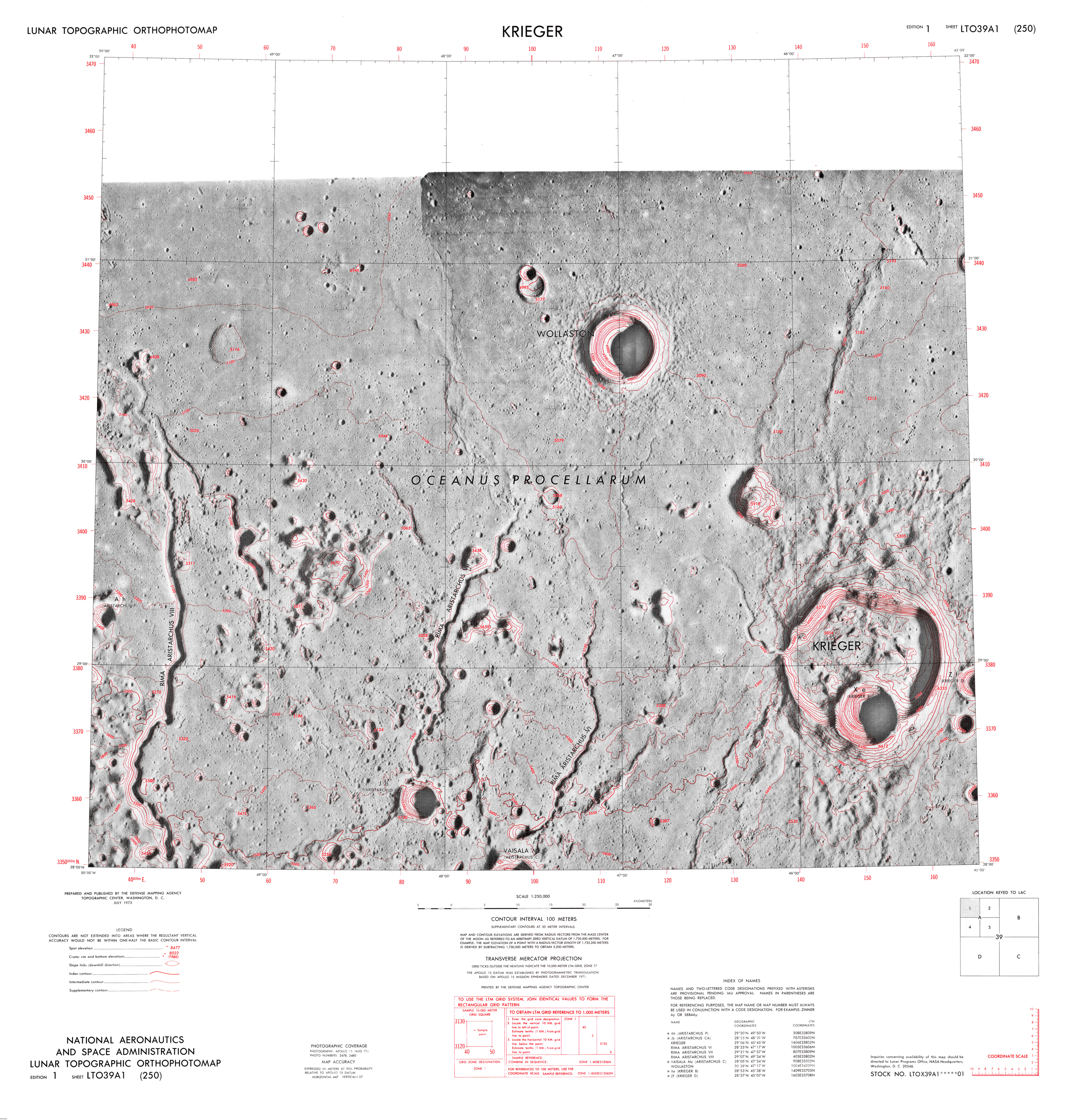
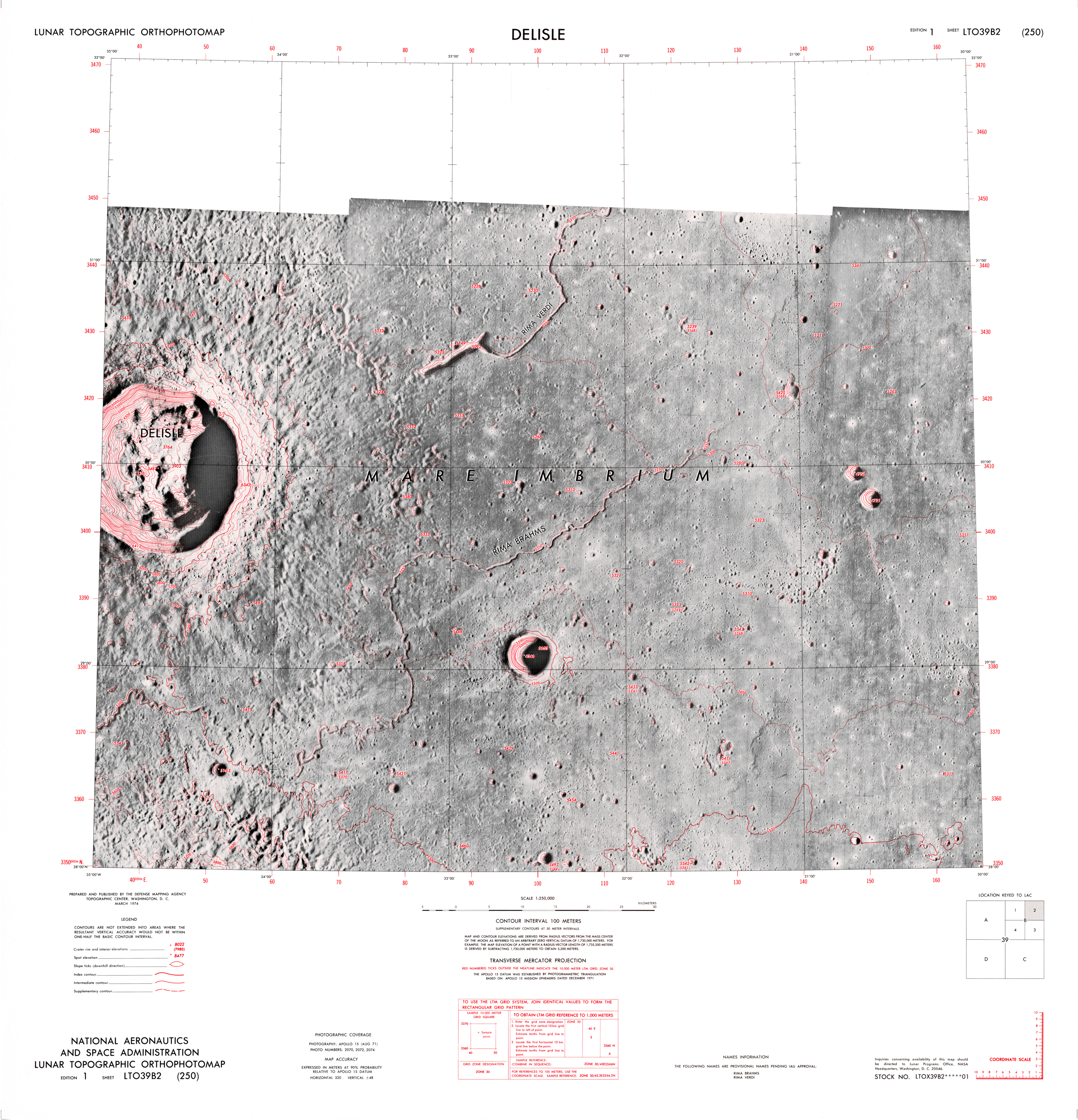
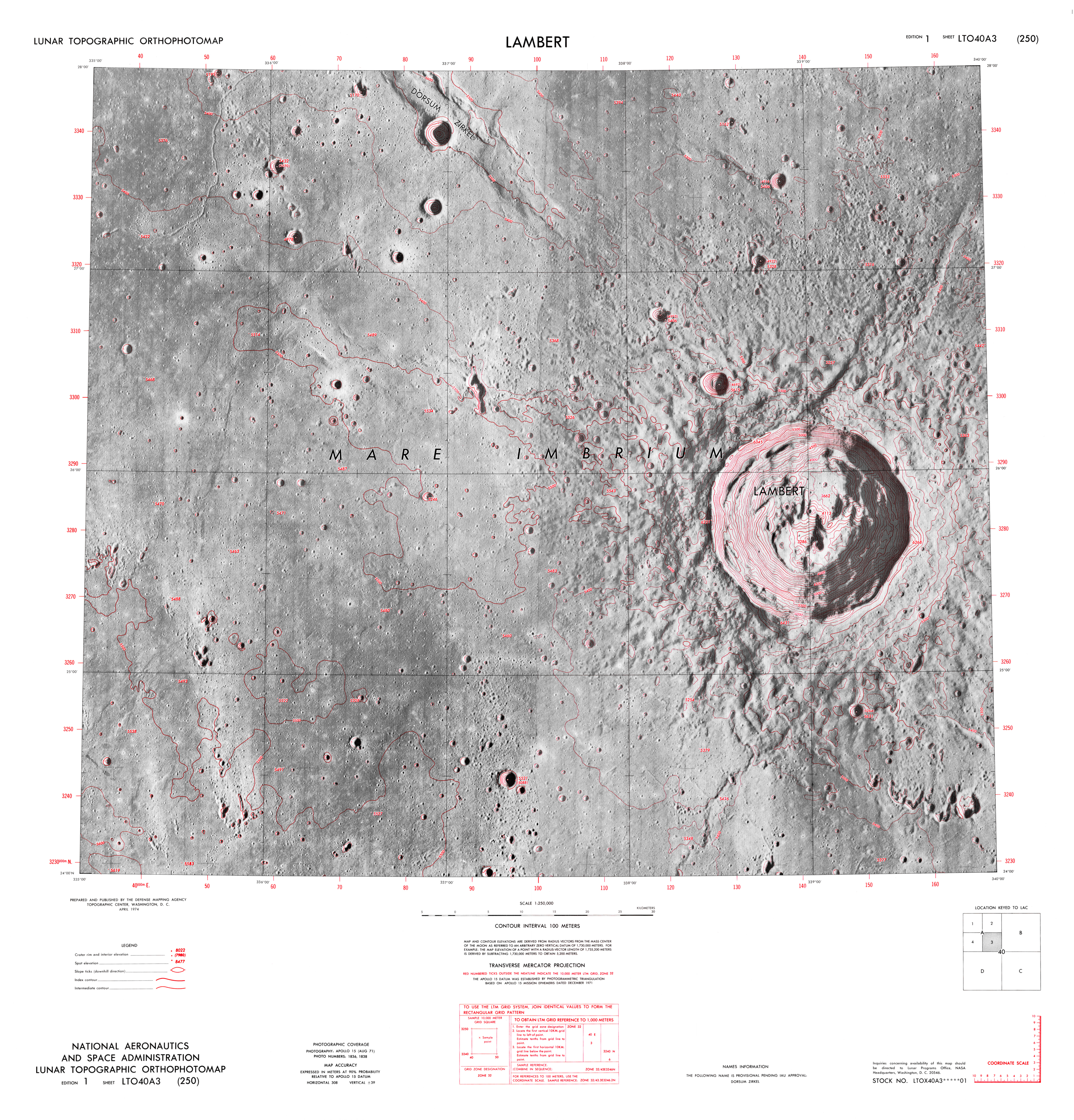
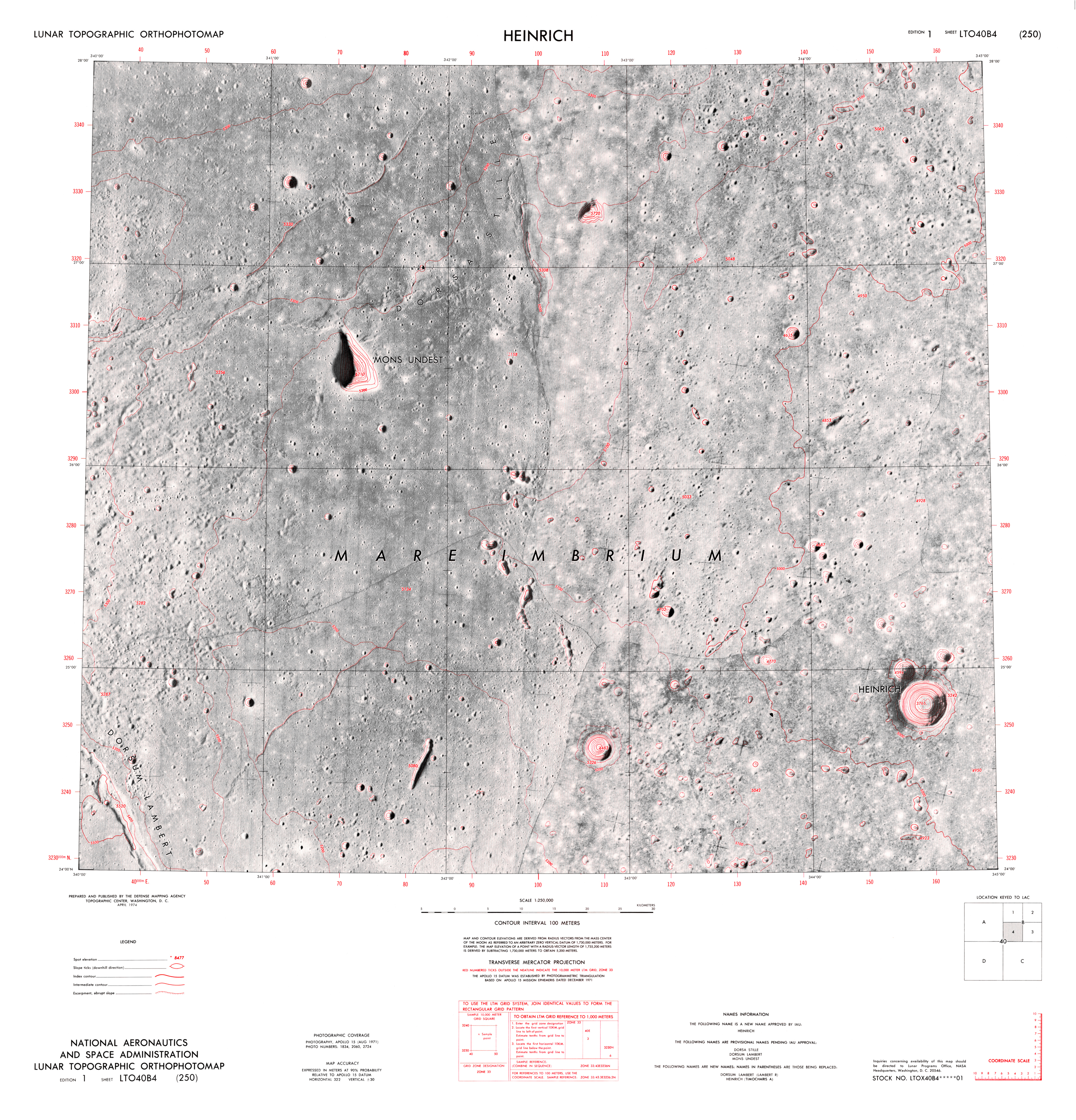
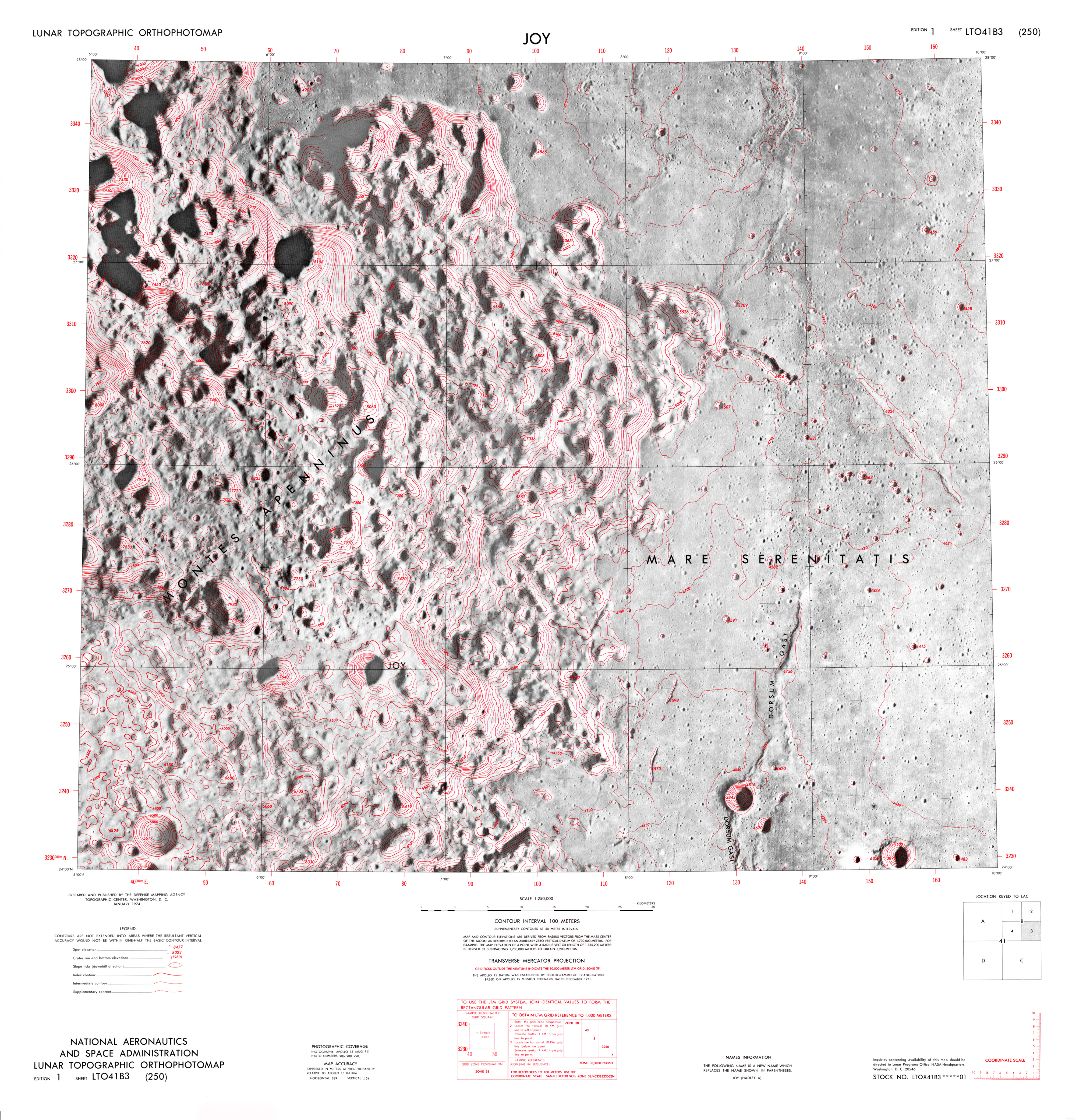
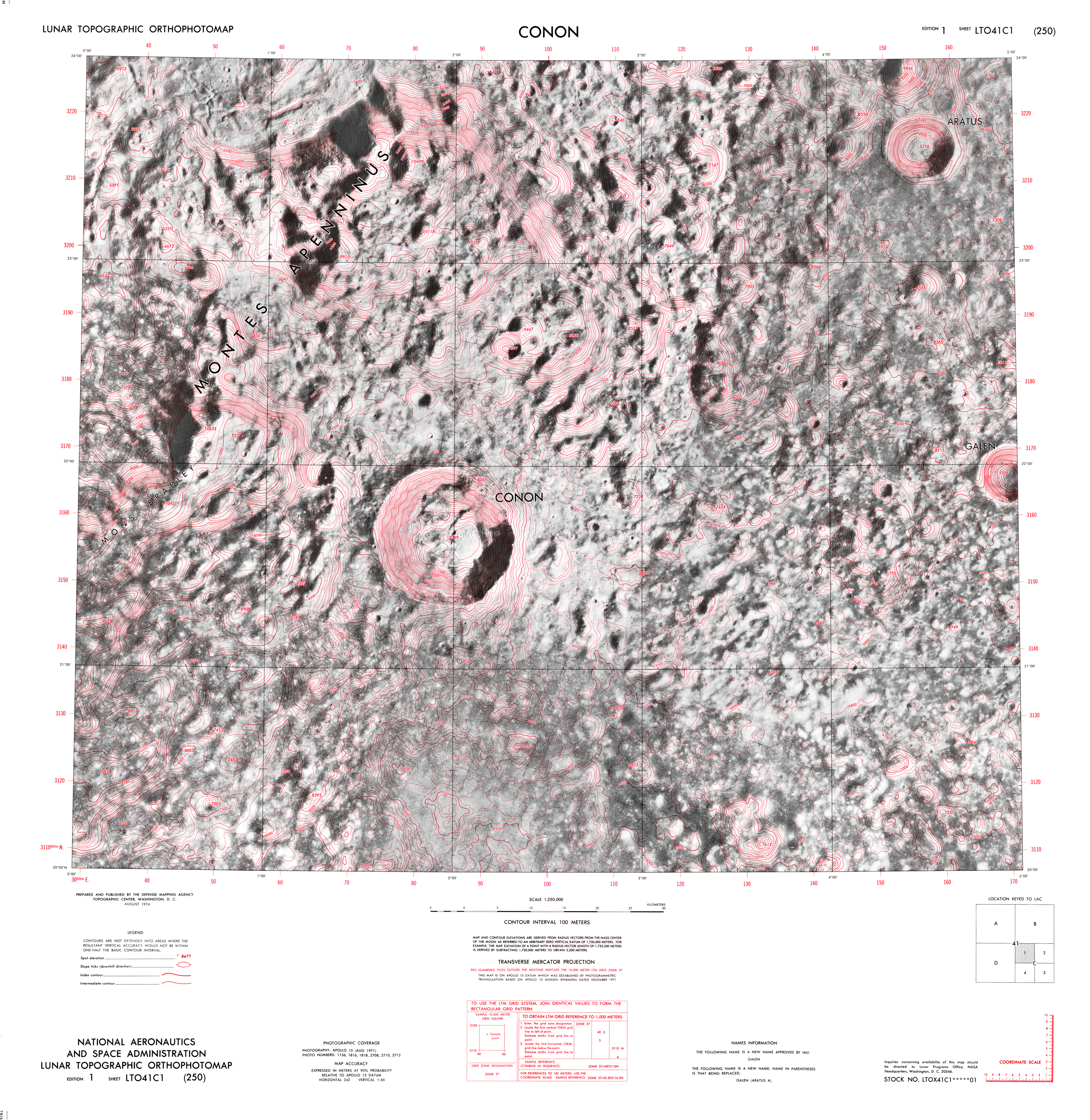
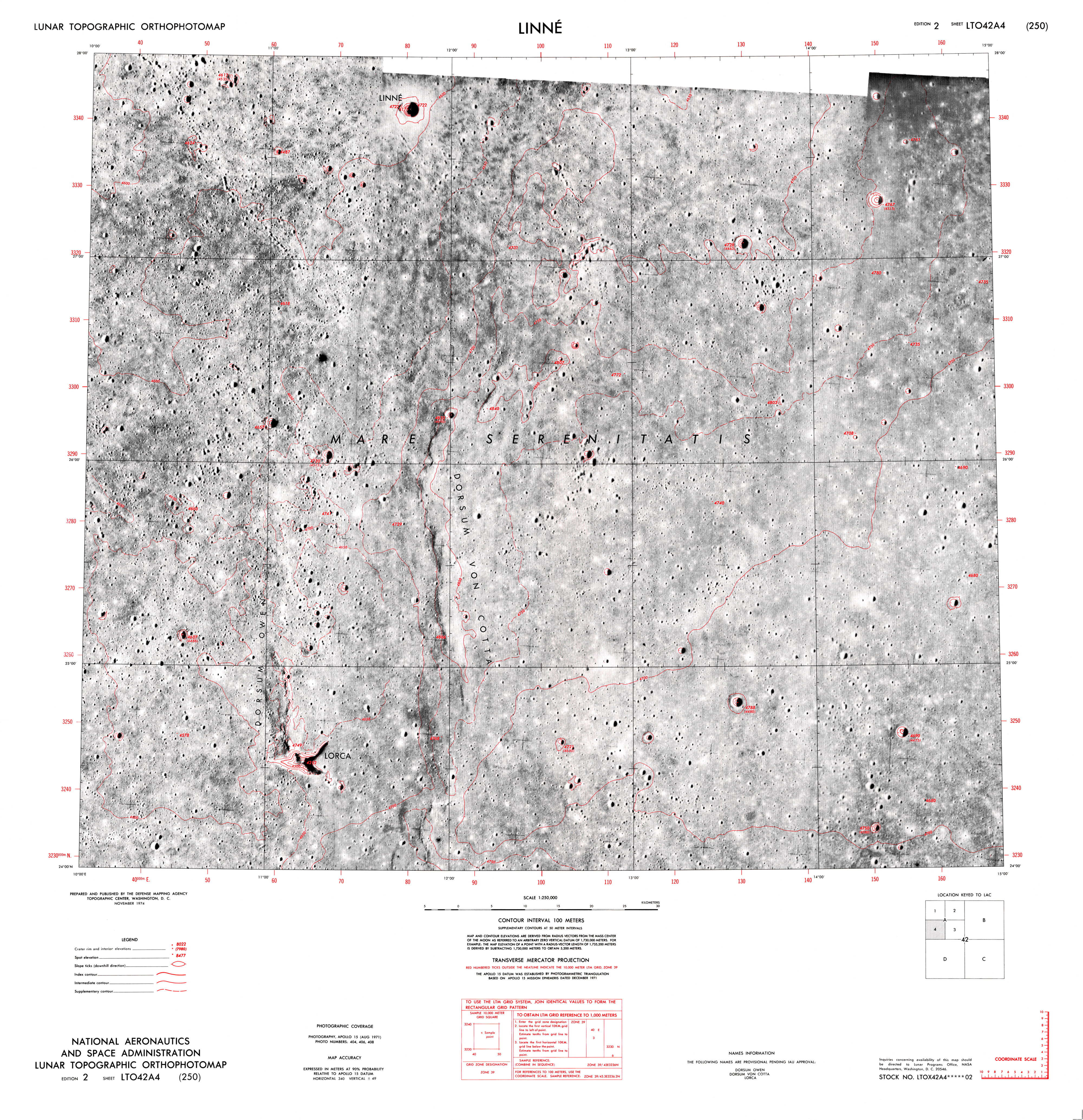
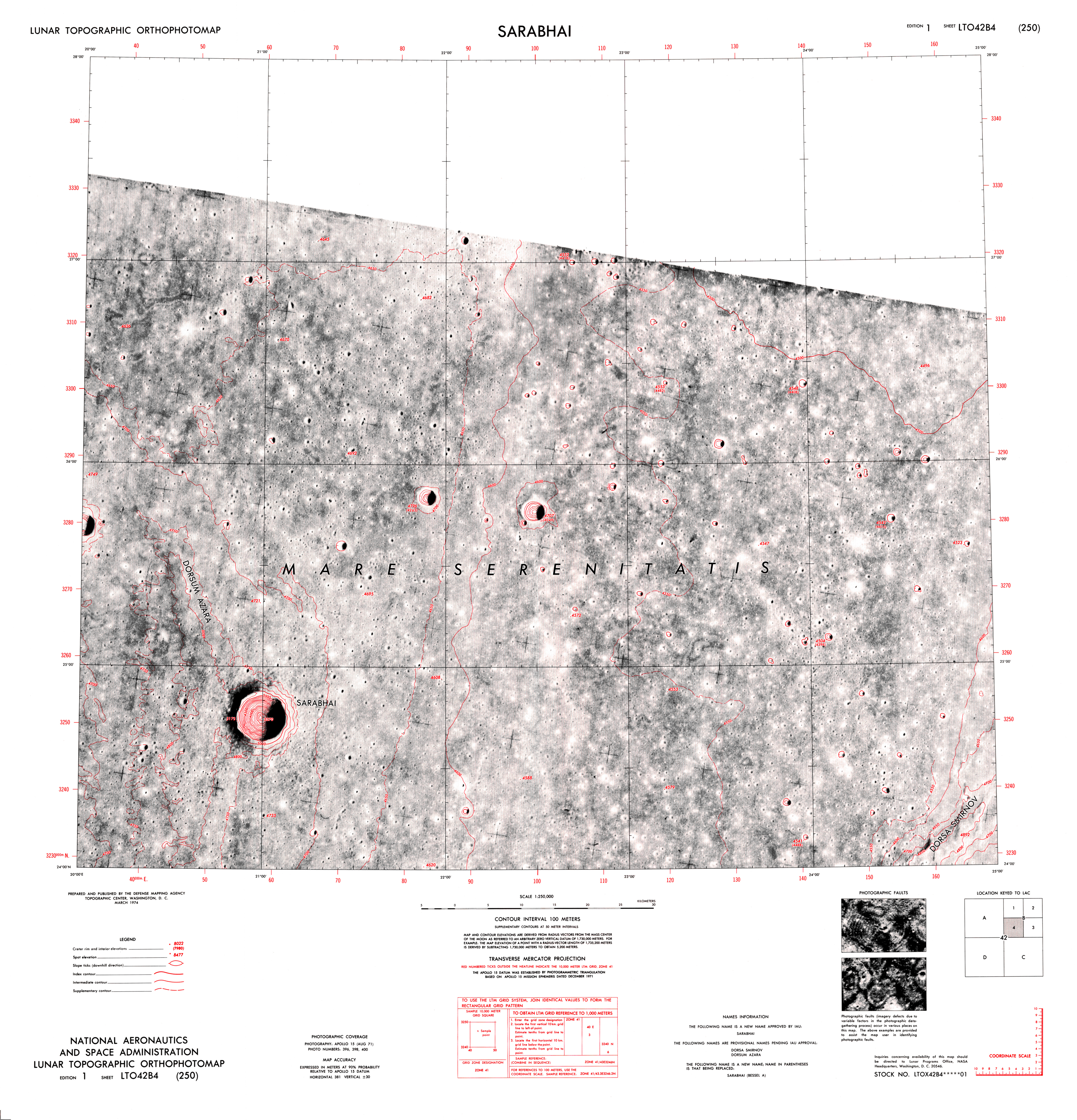
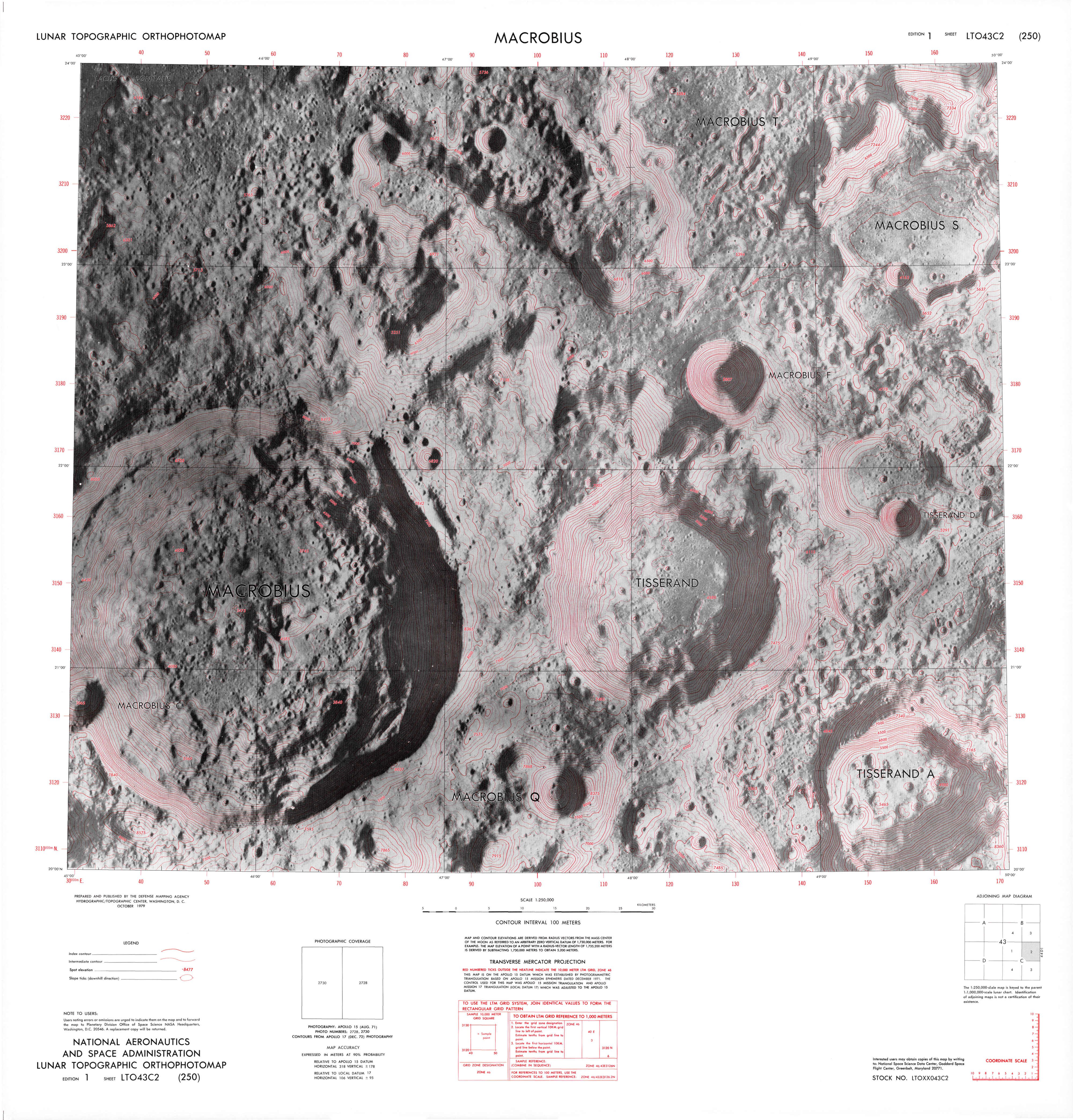
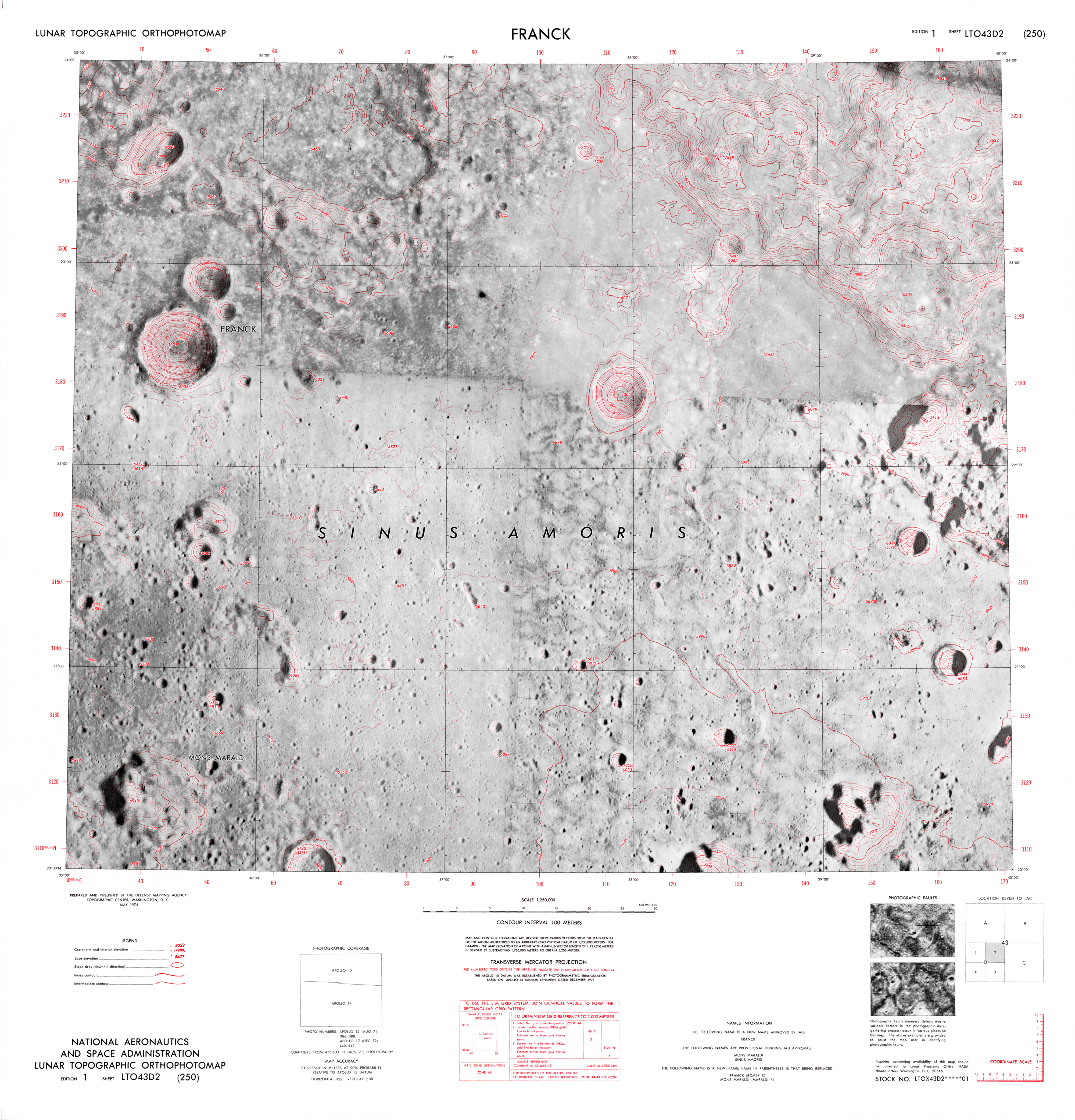
Scale: 1:25’,000
Projection: Transverse Mercator
Publié: Août 2016
Catégorie: Cartographie
Source