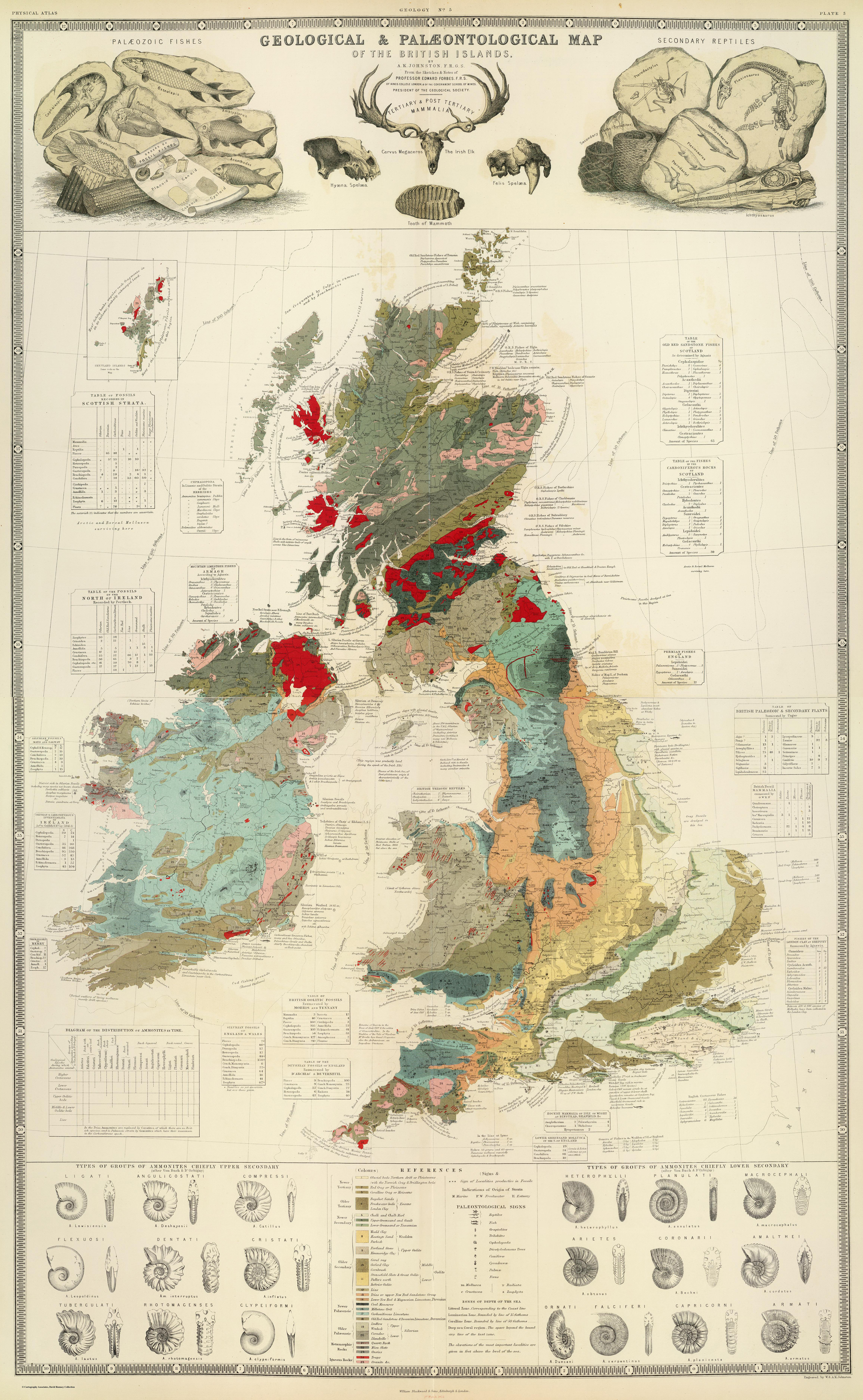
Cartographie

Edward Forbes

Geological, palaeontological map British Islands

1854

Geological, palaeontological map British Islands
Geological & palaeontological map of the British Islands, By A.K. Johnston, F.R.G.S. From the sketches & notes of Professor Edward Forbes, F.R.S. of Kings College London & of the Government School of Mines, President of the Geological Society, Engraved by W. & A.K. Johnston, William Blackwood & Sons, Edinburgh & London, 1st March 1854, (1856)
54°00'00.0"N 4°00'00.0"W

Lieu: British Islands

Author: Alexander Keith Johnston
Scale: 1:1’550’000
Collection: David Rumsey Map Collection


Publié: Novembre 2019
Catégorie: Cartographie