Richard Buckminster Fuller
Dymaxion World Map
1980
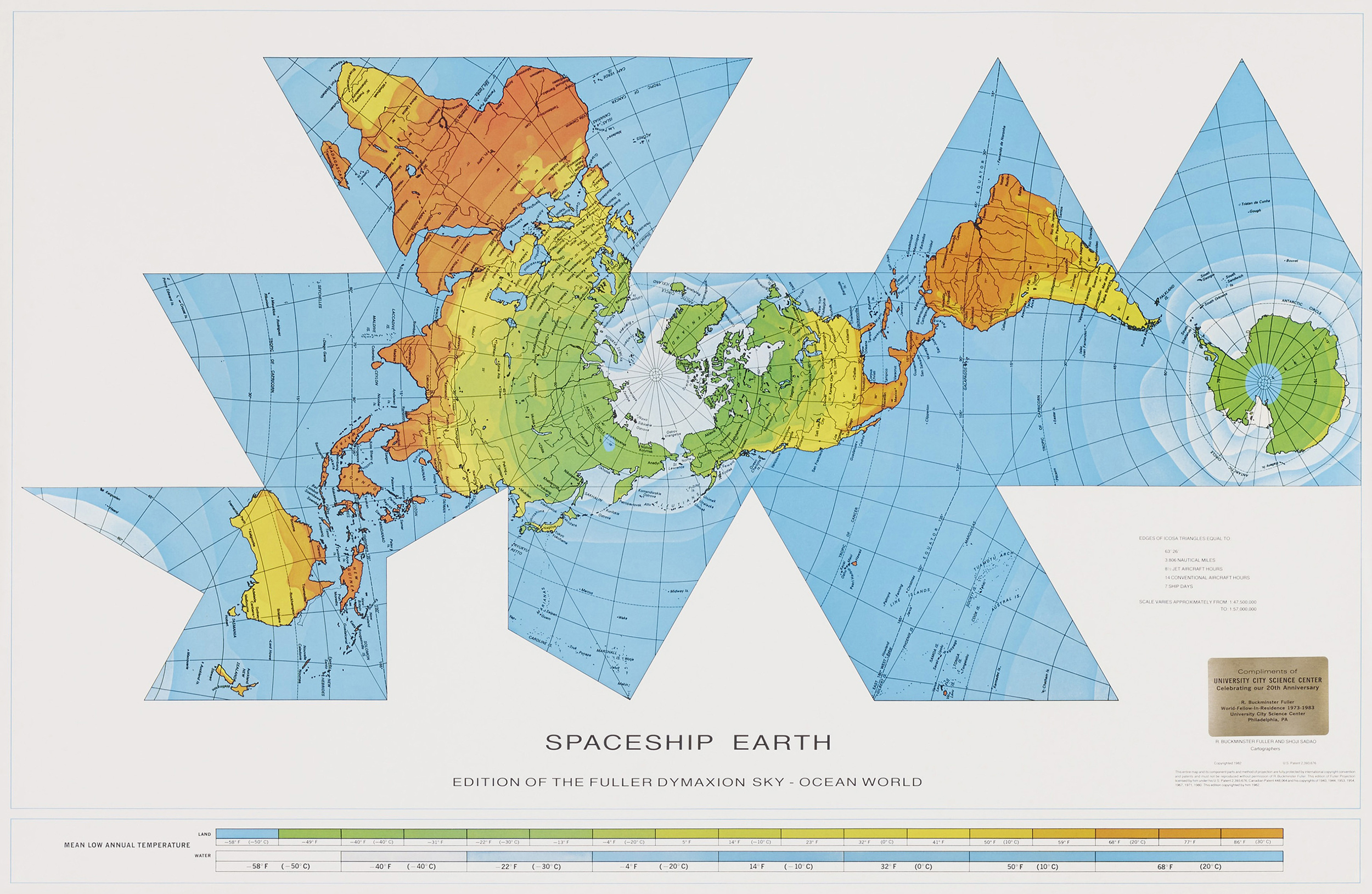
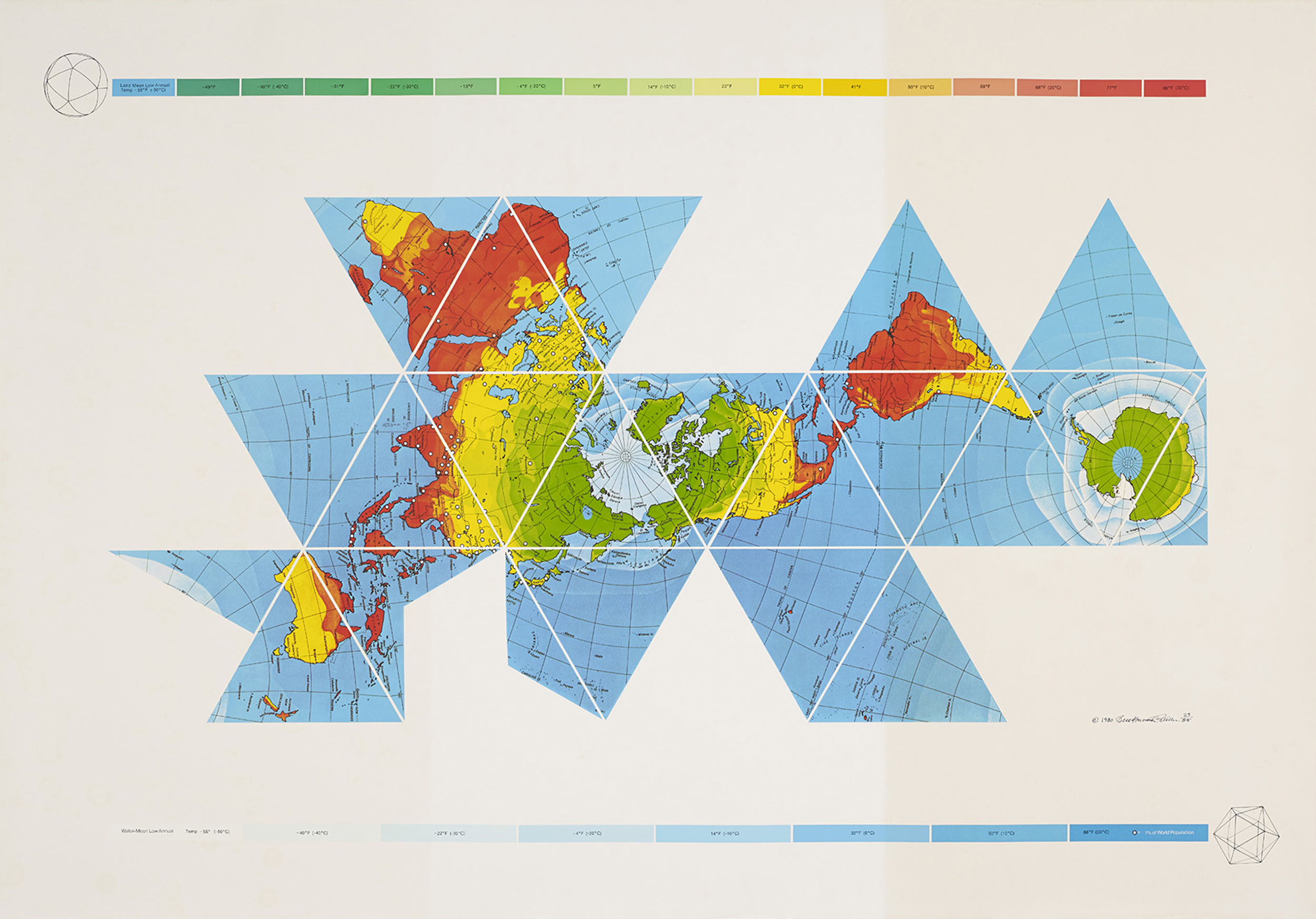
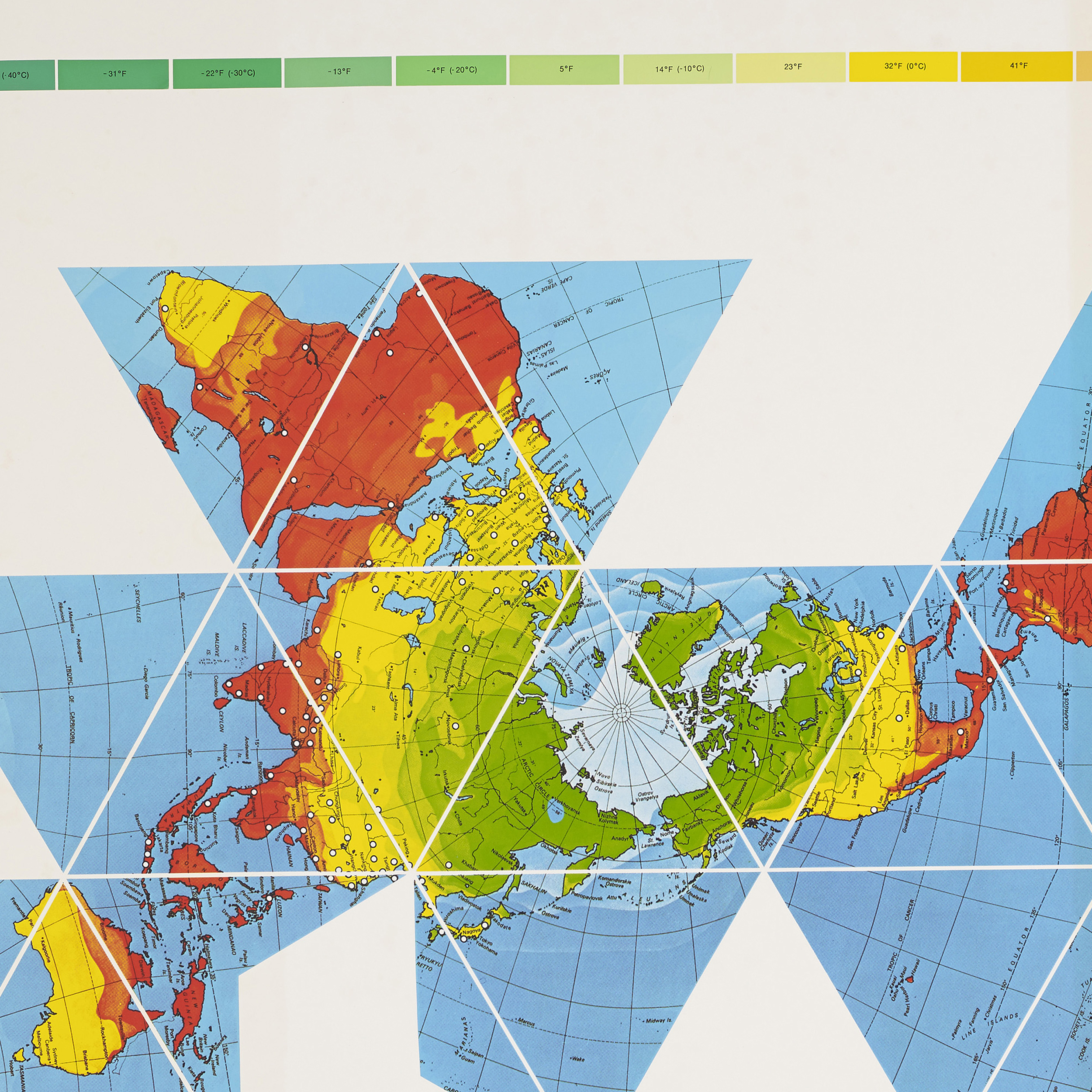
The Dymaxion map or Fuller map is a projection of a world map onto the surface of an icosahedron, which can be unfolded and flattened to two dimensions. The flat map is heavily interrupted in order to preserve shapes and sizes.
The projection was invented by Buckminster Fuller. The March 1, 1943 edition of Life magazine included a photographic essay titled “Life Presents R. Buckminster Fuller’s Dymaxion World”. The article included several examples of its use together with a pull-out section that could be assembled as a “three-dimensional approximation of a globe or laid out as a flat map, with which the world may be fitted together and rearranged to illuminate special aspects of its geography.” Fuller applied for a patent in the United States in February 1944, the patent application showing a projection onto a cuboctahedron. The patent was issued in January 1946.
The 1954 version published by Fuller, made with co-cartographer Shoji Sadao, the Airocean World Map, used a modified but mostly regular icosahedron as the base for the projection, which is the version most commonly referred to today. This version depicts the Earth’s continents as “one island”, or nearly contiguous land masses.
The Dymaxion projection is intended only for representations of the entire globe. It is not a gnomonic projection, whereby global data expands from the center point of a tangent facet outward to the edges. Instead, each triangle edge of the Dymaxion map matches the scale of a partial great circle on a corresponding globe, and other points within each facet shrink toward its middle, rather than enlarging to the peripheries.
Gallery: Carl Solway Gallery, Cincinnati
Dimension: 127 x 183 cm
Text: Wikipedia
Publié: Mars 2018
Catégorie: Cartographie