Charles Booth
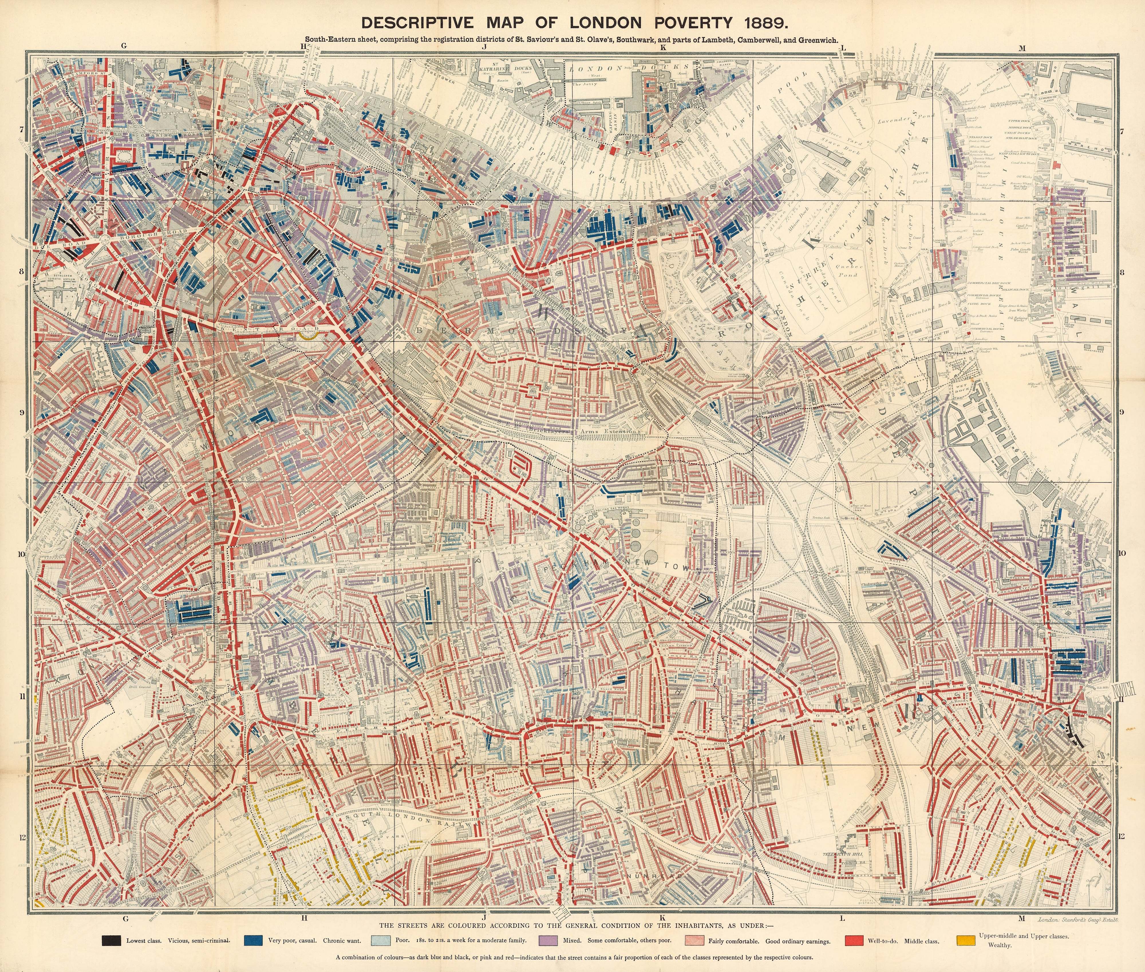
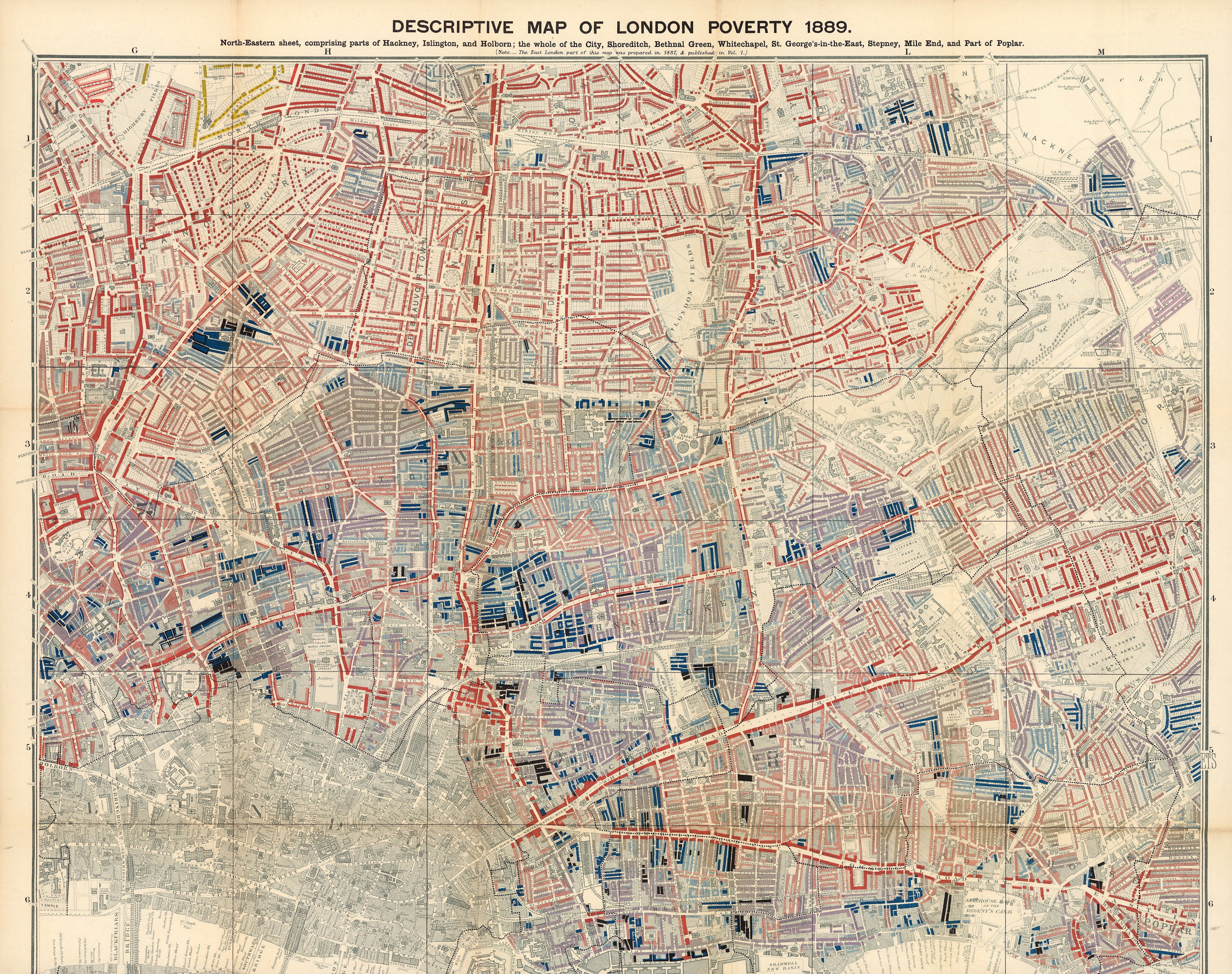
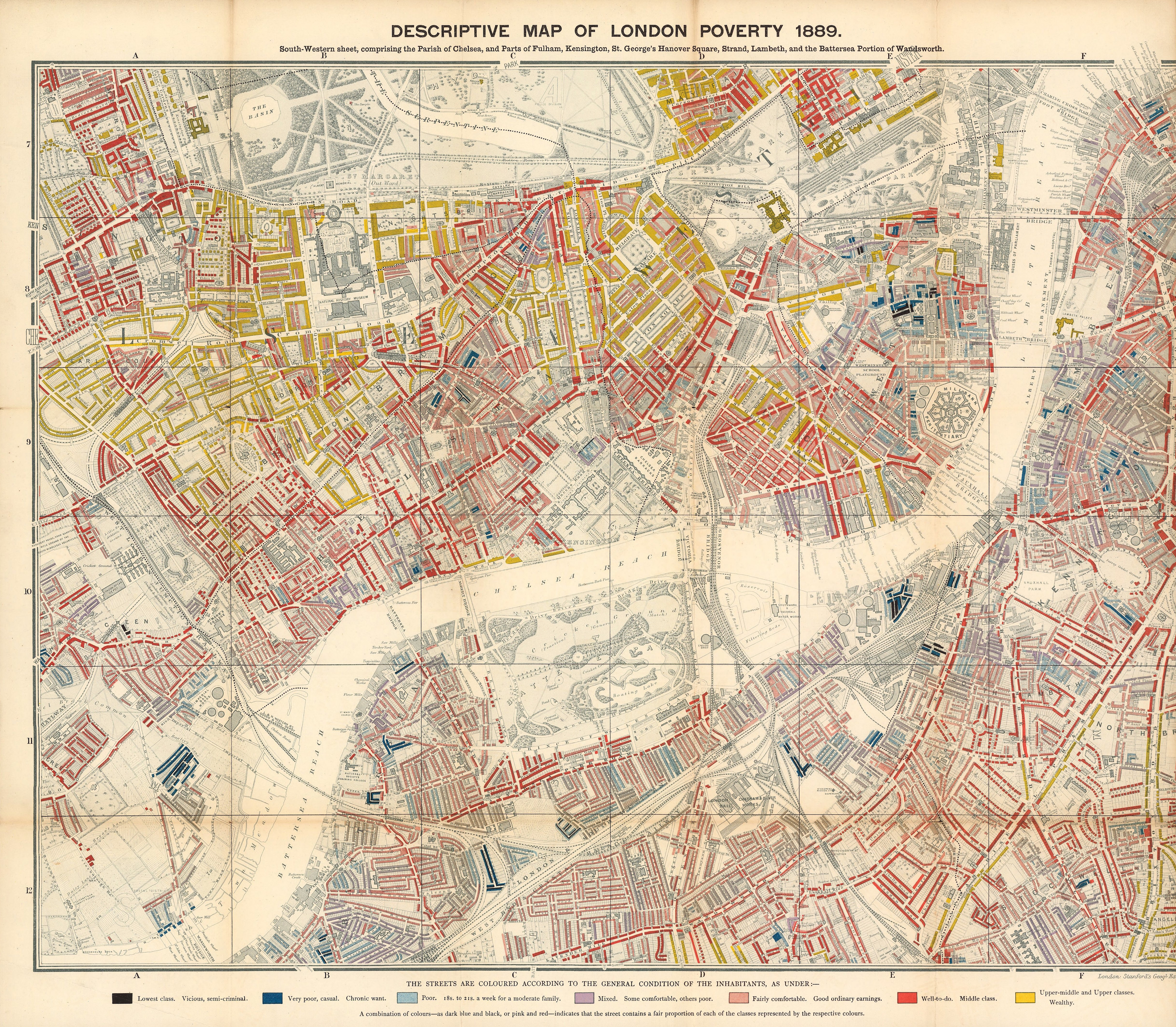
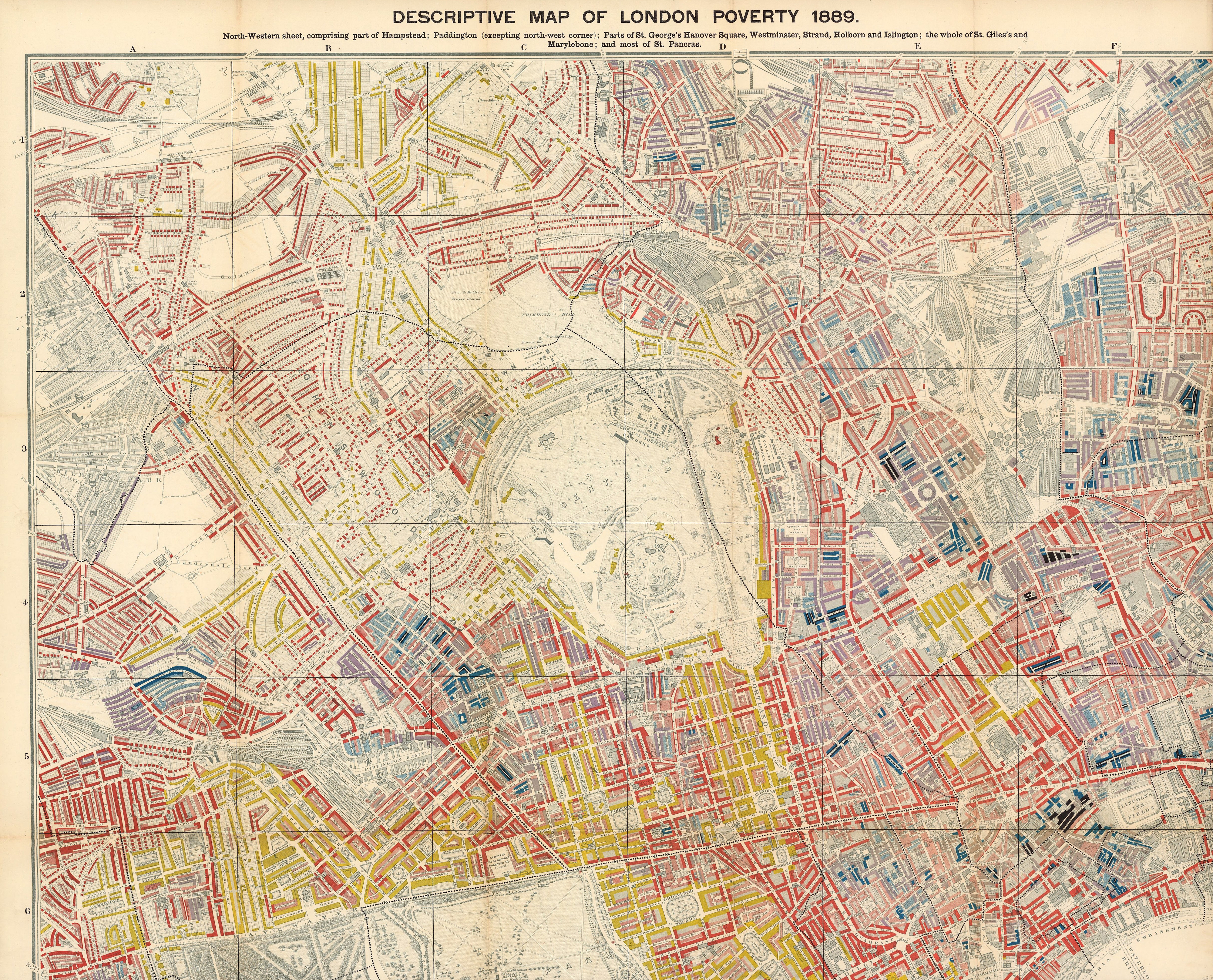
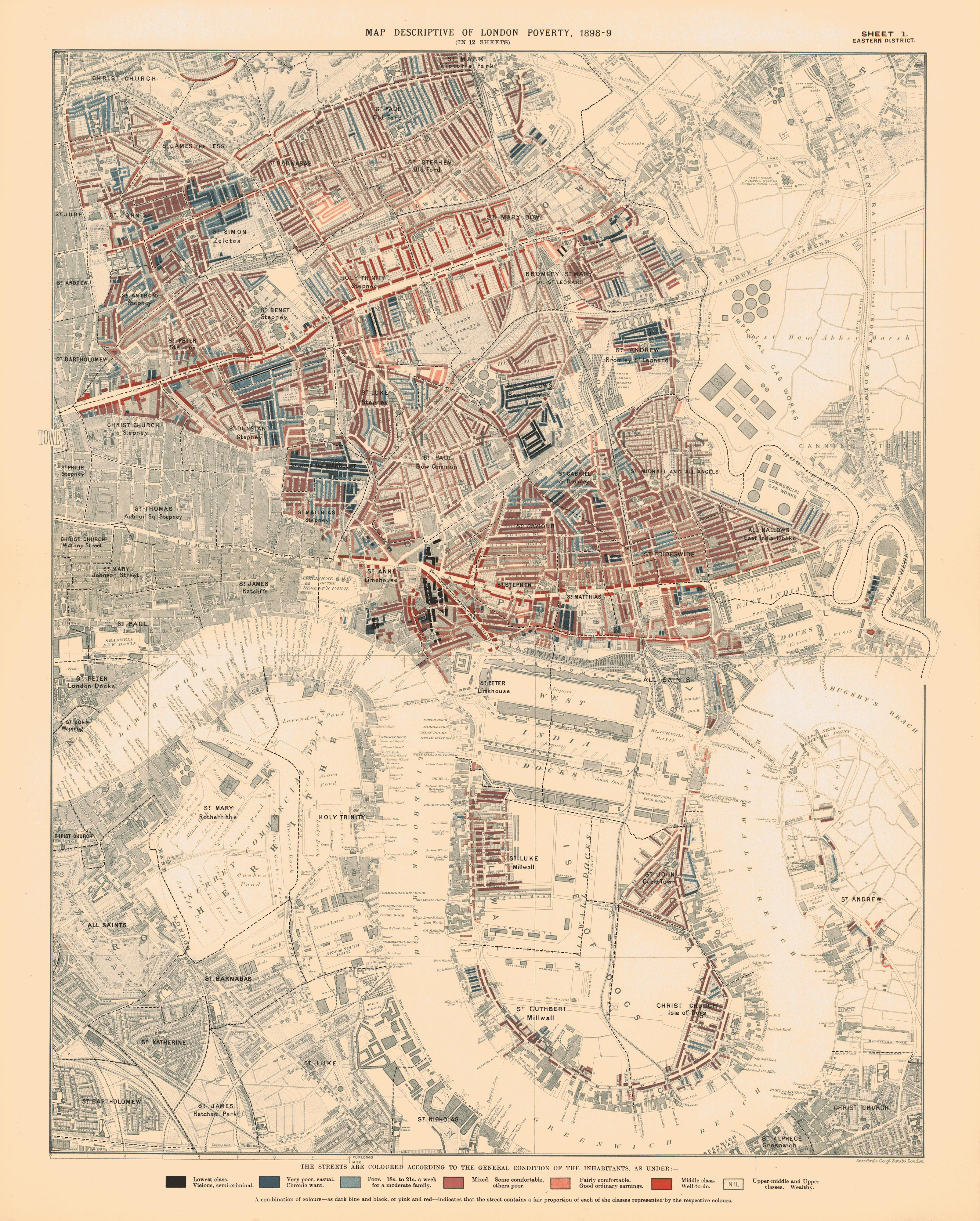
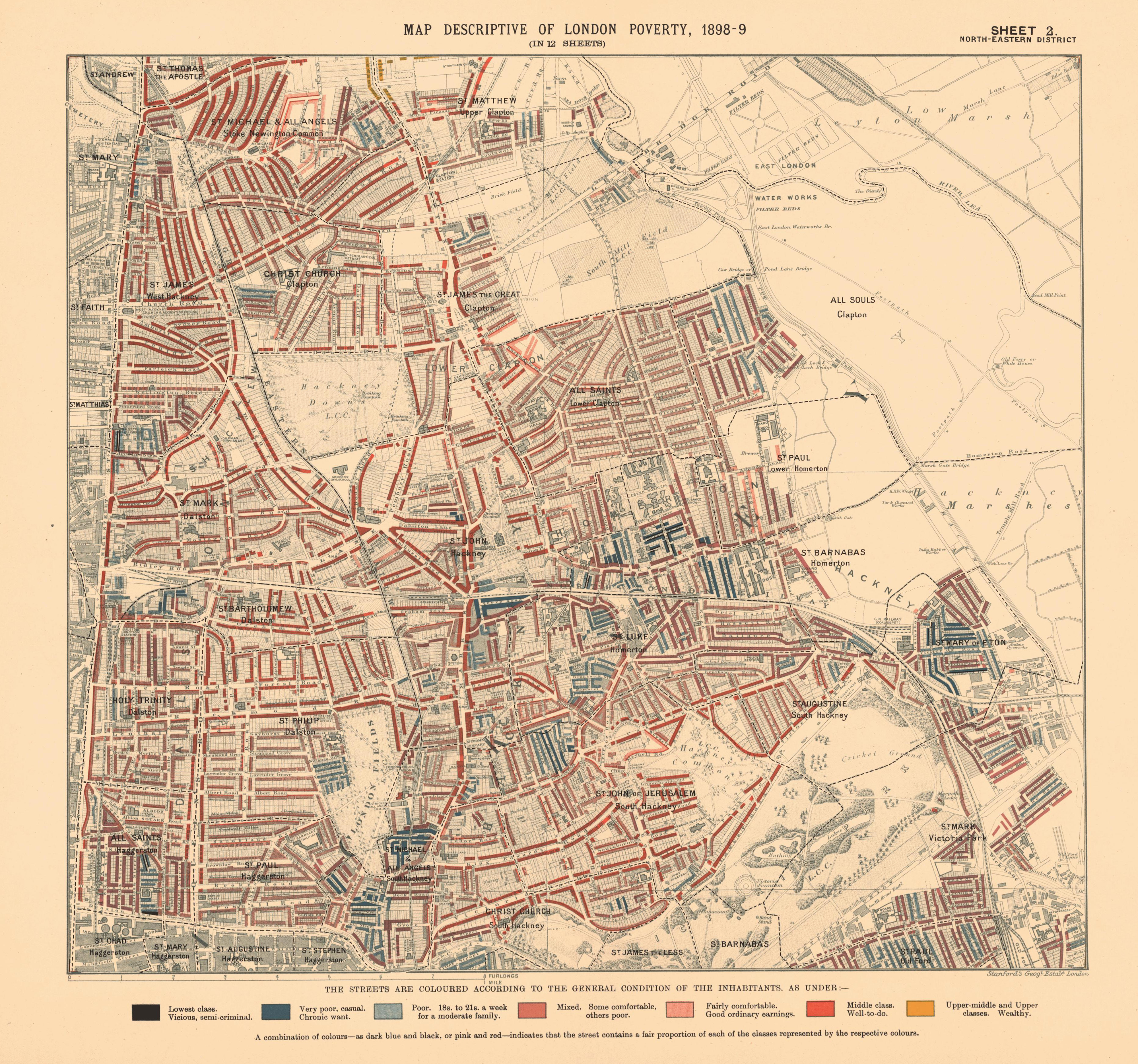
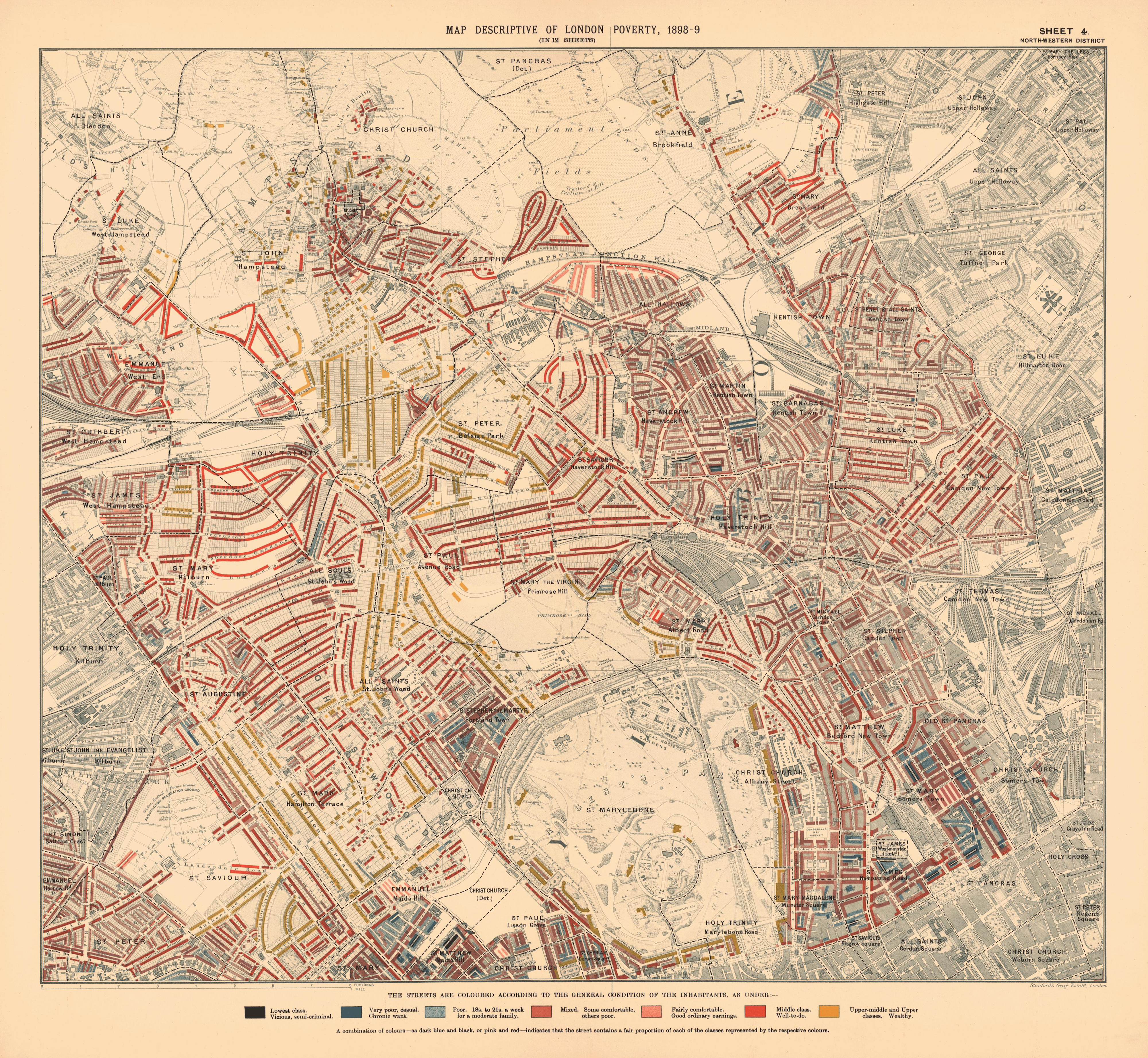
Descriptive map of London poverty
1889
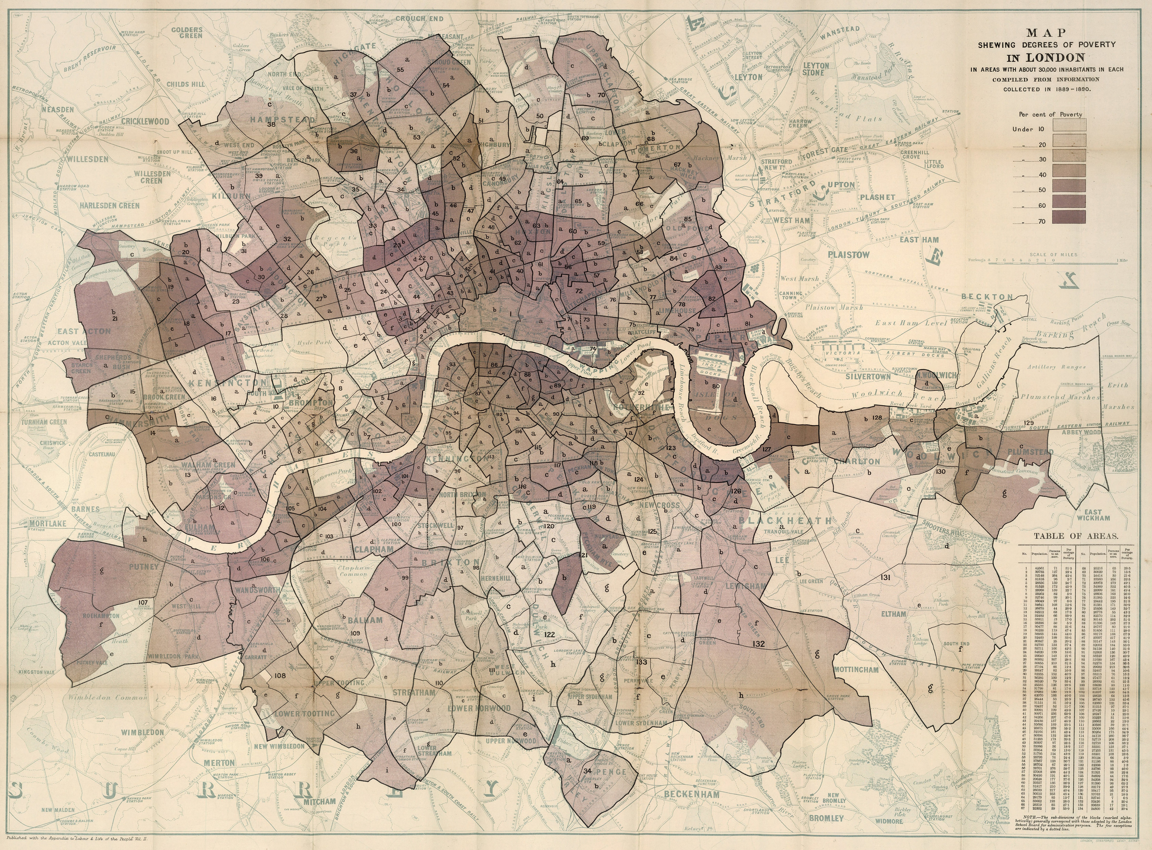
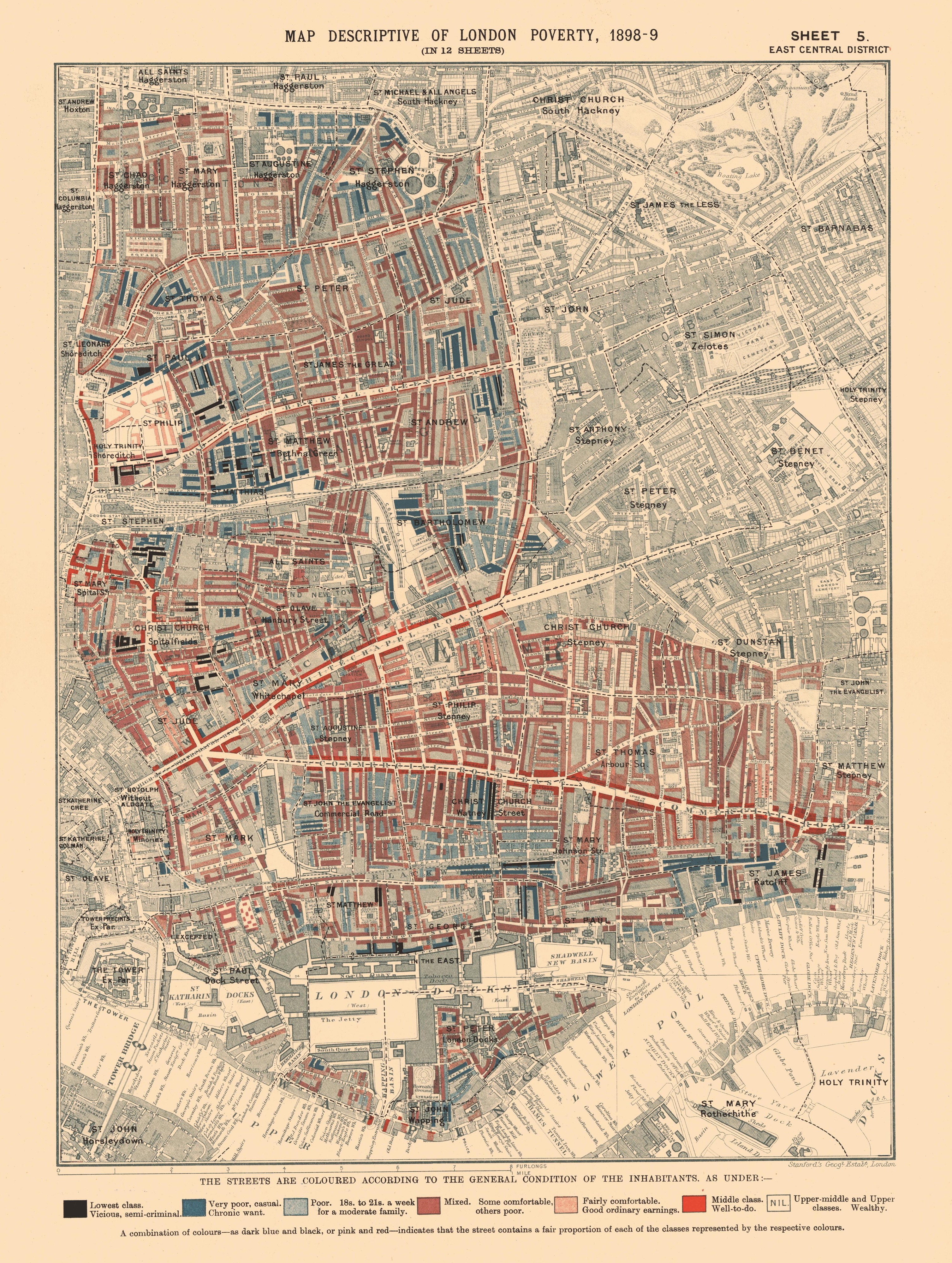
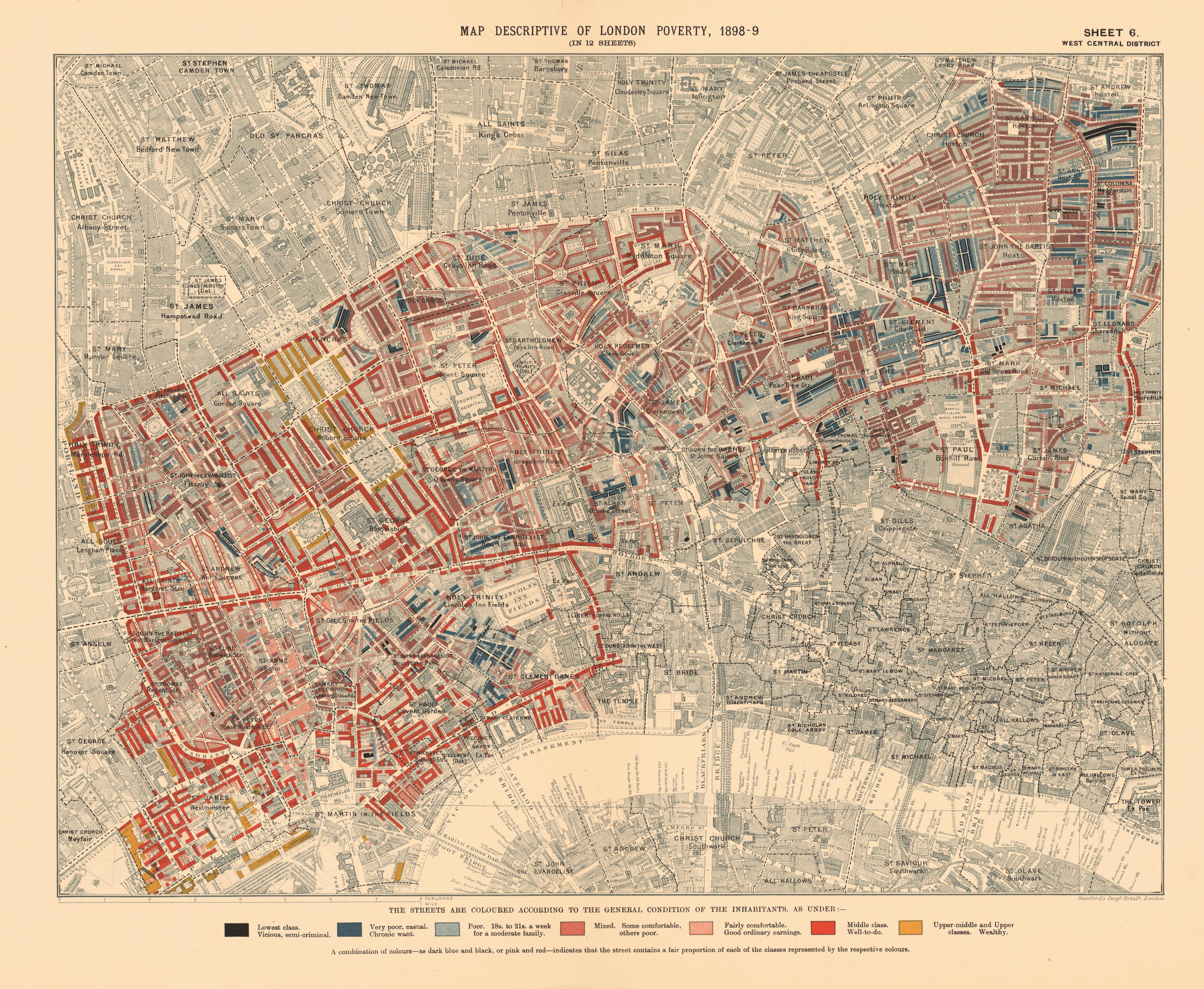
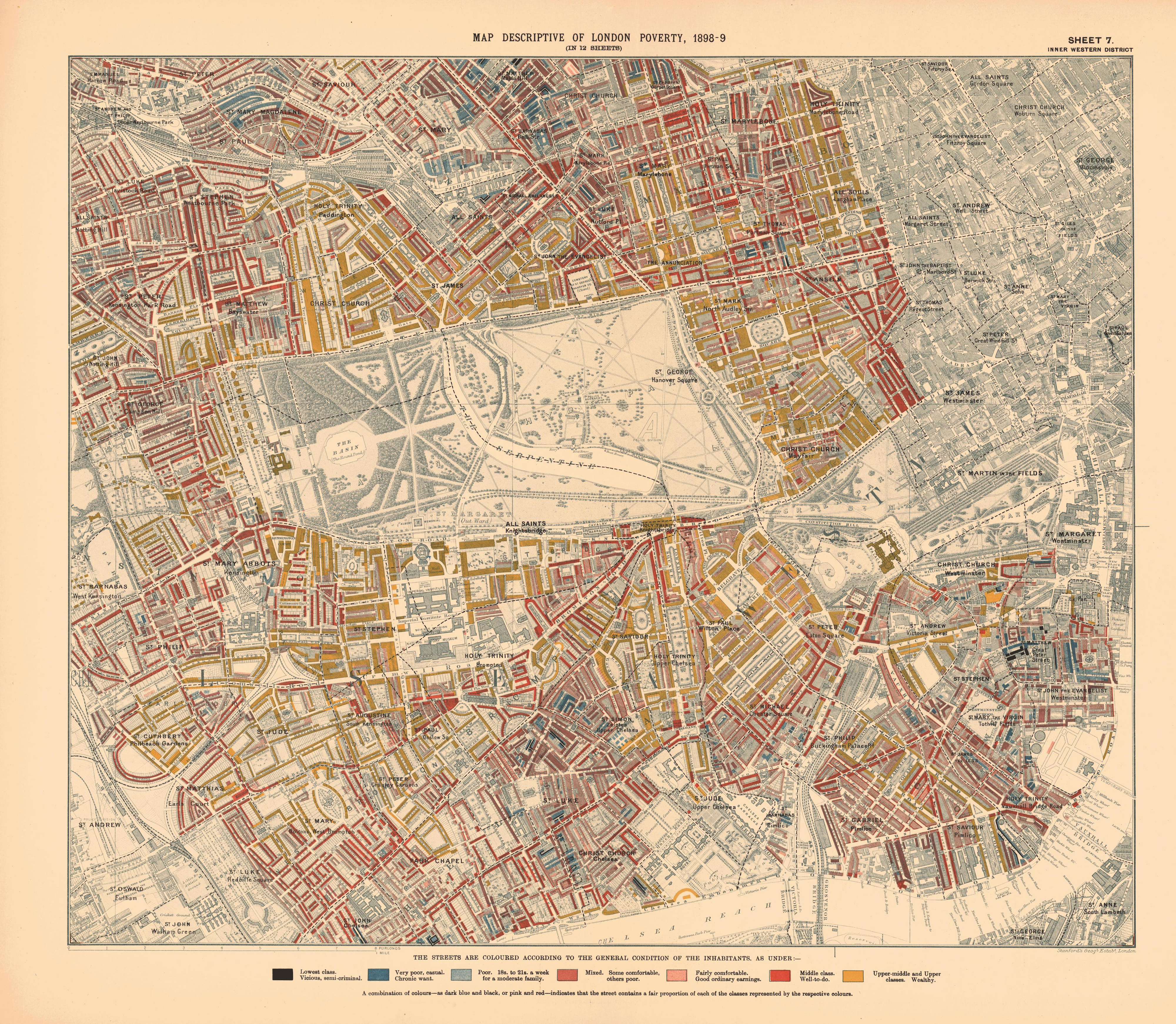
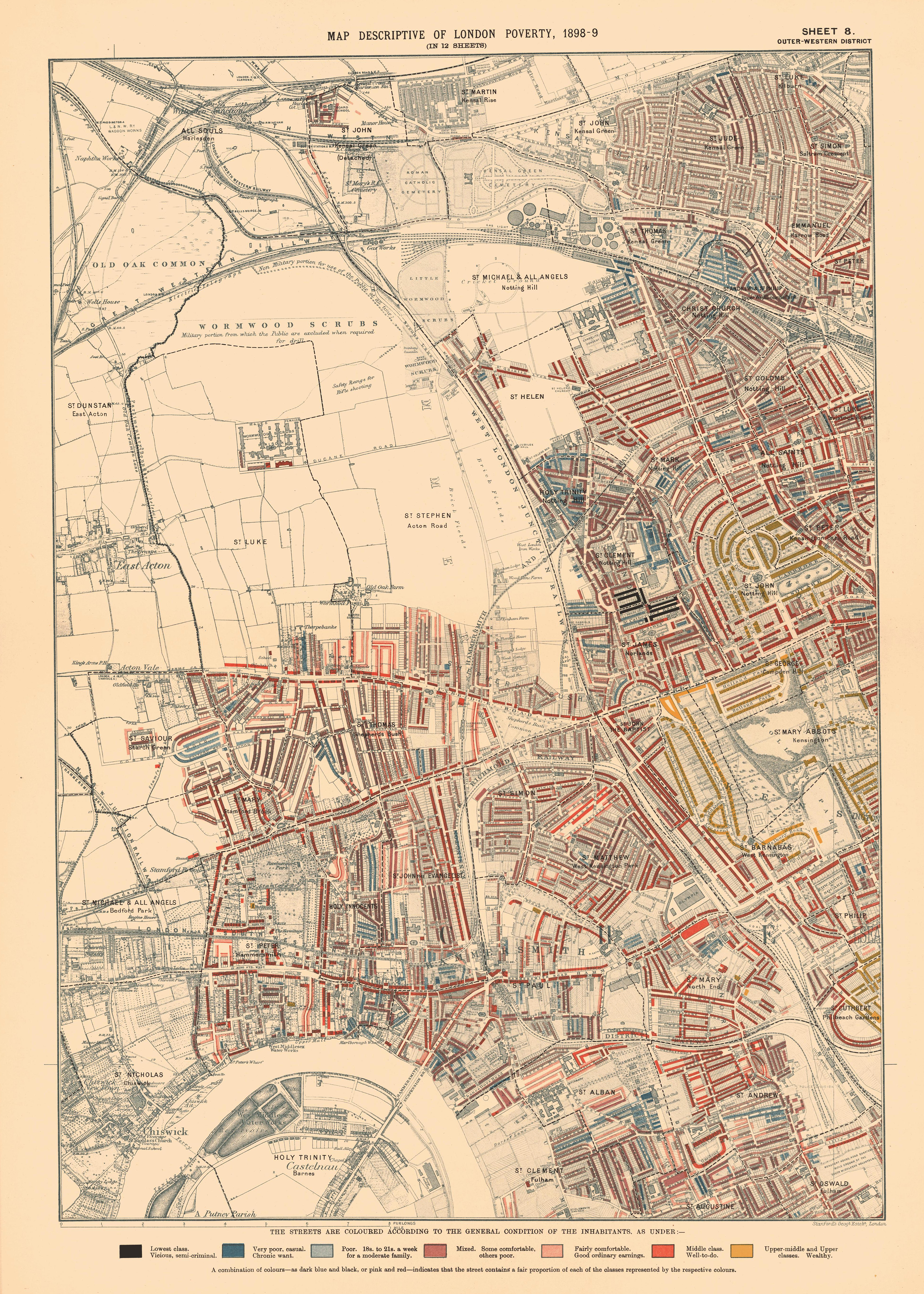
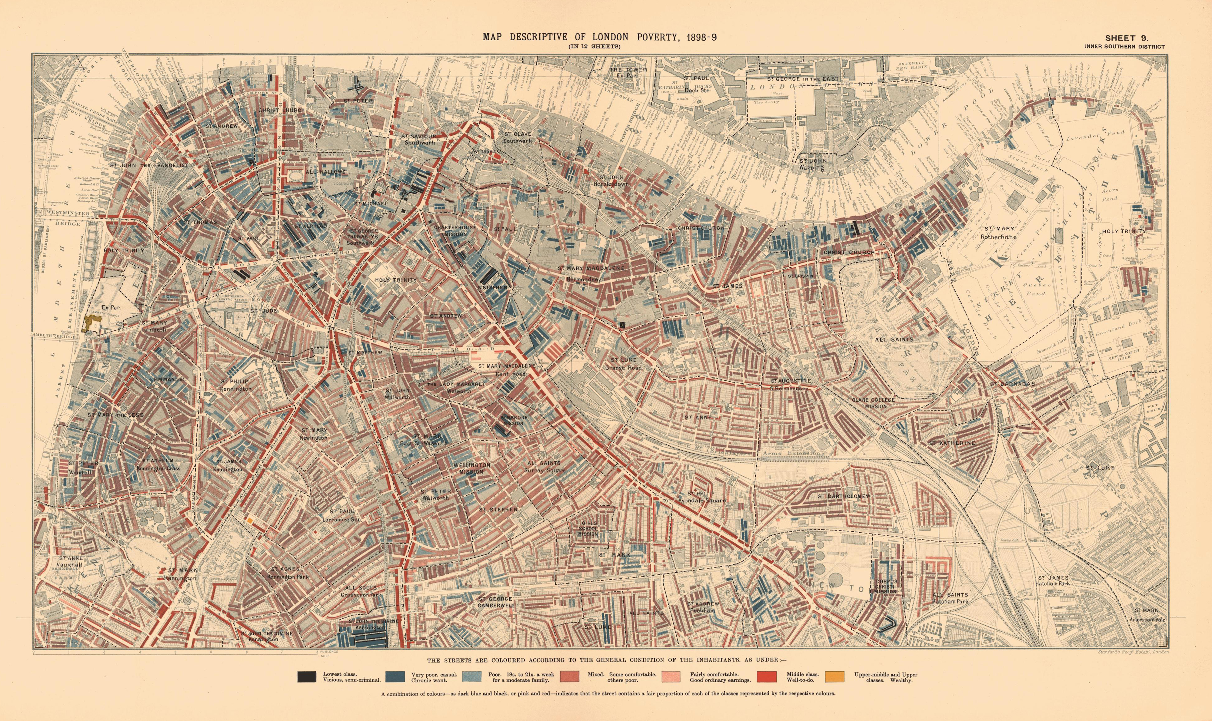
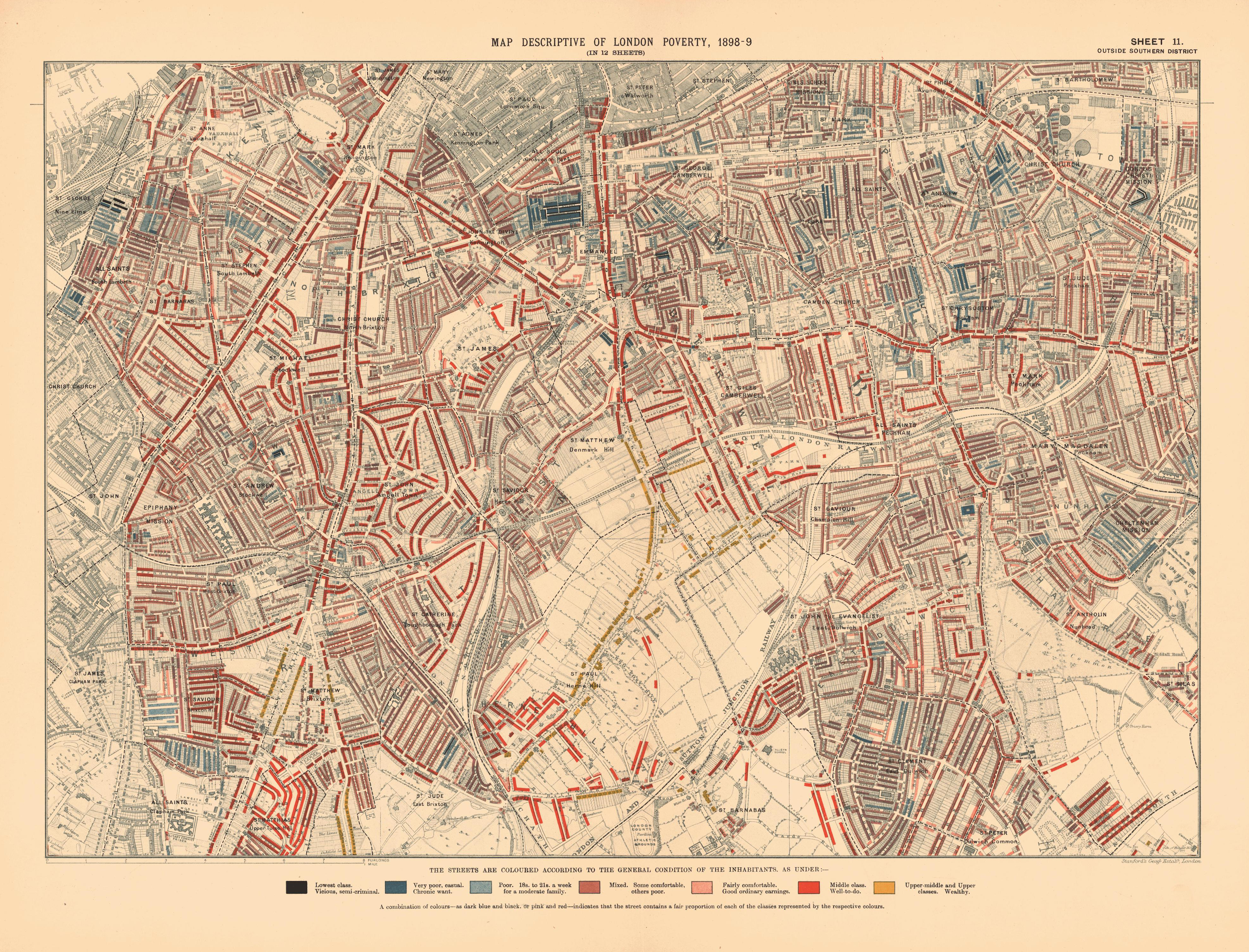
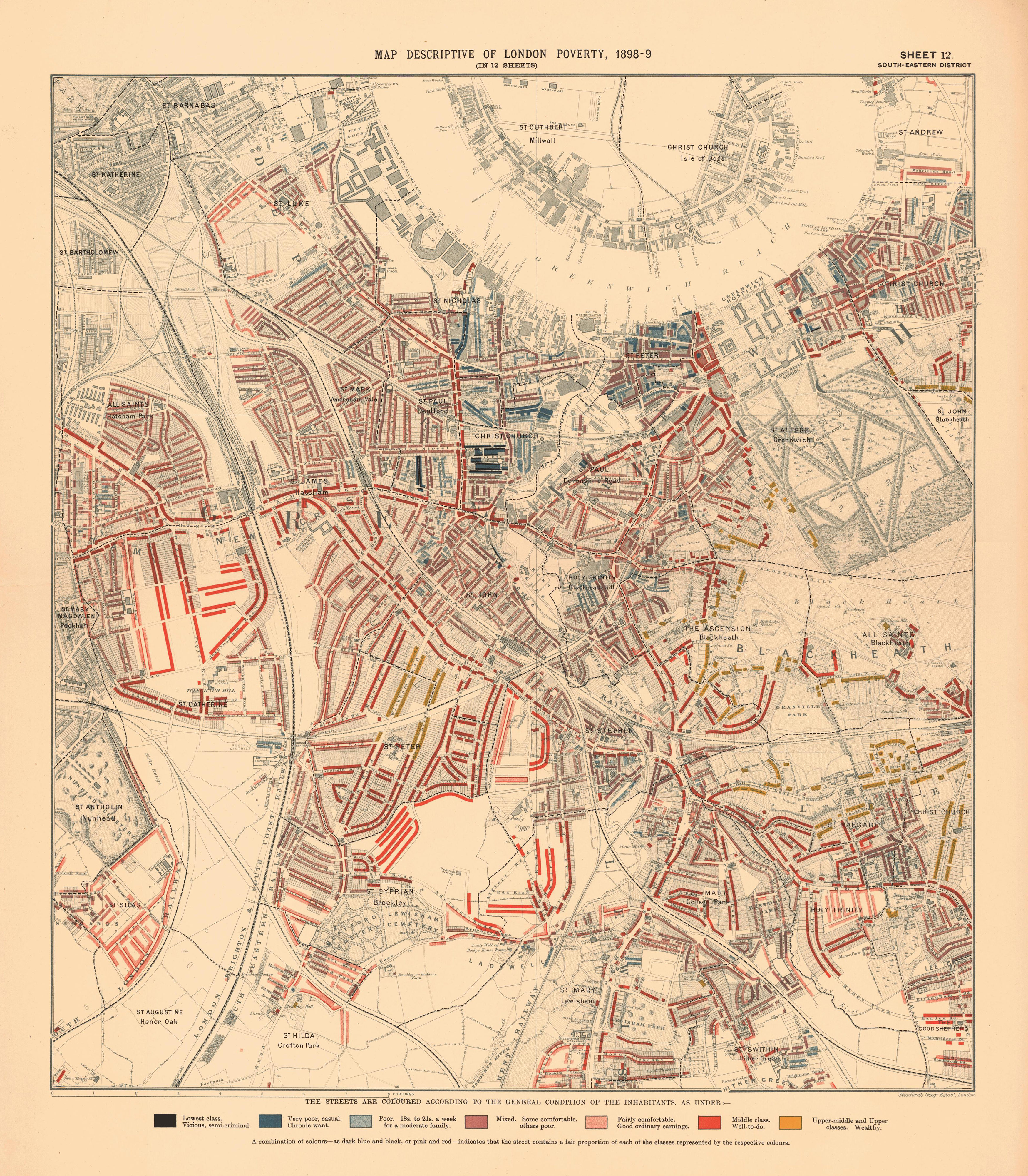
Detailed town plan to show resident’s means in 7 classes, wealth to poverty. Bound in olive cloth covered boards with title “Labour and life of the people : Maps etc. Appendix to Vol. 2.” stamped on cover and on spine. Charles Booth’s Inquiry into the Life and Labour of the People in London, undertaken between 1886 and 1903 was one of several surveys of working class life carried out in the 19th century. It is the only survey for which the original notes and data have survived and therefore provides a unique insight into the development of the philosophy and methodology of social investigation in the United Kingdom. Booth’s four sheet Poverty map colour-coded streets according to the degree of wealth of the inhabitants, ranging from black (‘Lowest class’), through shades of blue and purple (‘Poor’, ‘Mixed’, ‘Fairly Comfortable’), to red (‘Well to do’) and yellow (‘Wealthy’). Booth (1840-1916), owner of the Booth Shipping Line, acted in response to an 1886 Pall Mall Gazette article that claimed that 25% of Londoners lived in poverty. Booth regarded this figure as wildly exaggerated, so recruited a team of volunteer researchers (including his cousin Beatrix Potter) to compile an analysis of social conditions based on field visits and interviews with local police, clergy and employers. The First Series of ‘Life and Labour’ (1889 maps shown here), covering the East End, showed that 35% lived in poverty (with thanks to Altea Gallery notes).


Lieu: London, United Kingdom
Editor: Edward Stanford Ltd.
Composite: (London) Descriptive map of London poverty
Collection: David Rumsey Map Collection
Publié: Décembre 2016
Catégorie: Cartographie