Théophile-Jean Delaye
Carte du massif du Toubkal
1936
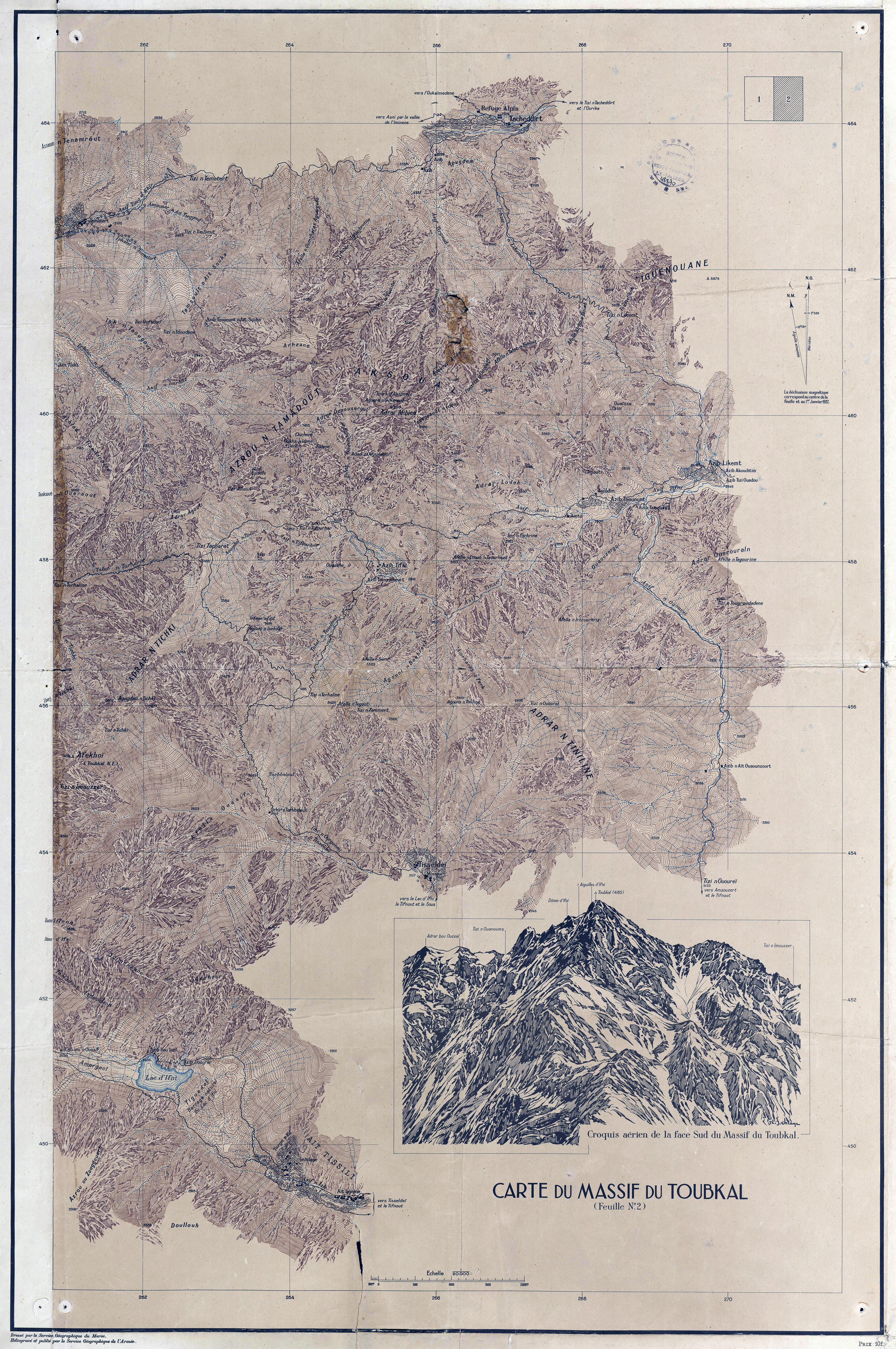
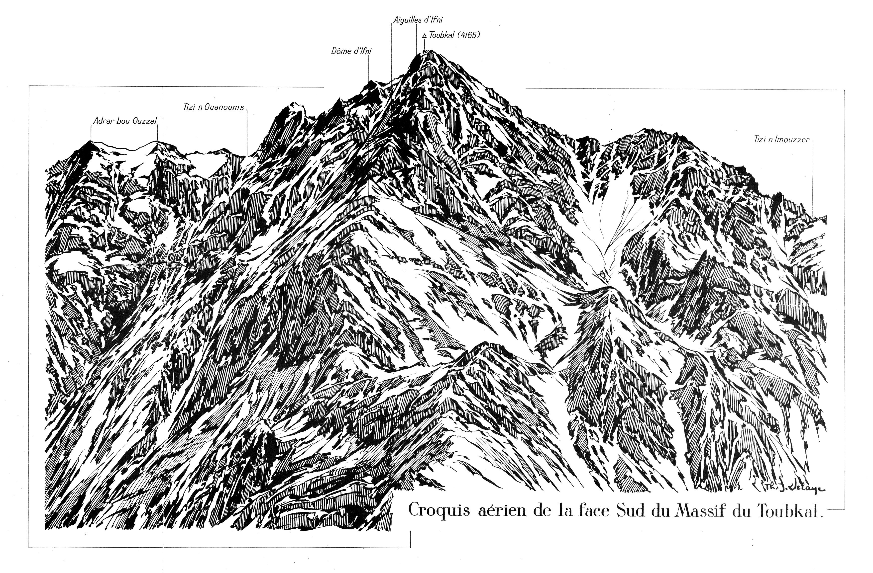
The production of a map of the Toubkal mountain range on a scale of 1:20’000 in 1937 was an important stage in the mapping of Morocco’s mountains. Produced under the supervision of Théophile-Jean Delaye, an army topographer, who was also a mountain climber and illustrator, it marked the end of reconnaissance mapping at a time when the Protectorate sought to give new value to the mountains of Morocco.

31°03'33.0"N 7°54'57.0"W
Lieu: Toubkal, Atlas Mountains
Publié: Janvier 2020
Catégorie: Cartographie
Lieu: Toubkal, Atlas Mountains
Collaborators: Service géographique (Maroc) - Service géographique de l’armée (France)
Editor: Université Bordeaux Montaigne
Scale: 1:20’000
Text: Aurélia Dusserre
Publié: Janvier 2020
Catégorie: Cartographie