USGS
Alaska Topographic Maps
1902–1938
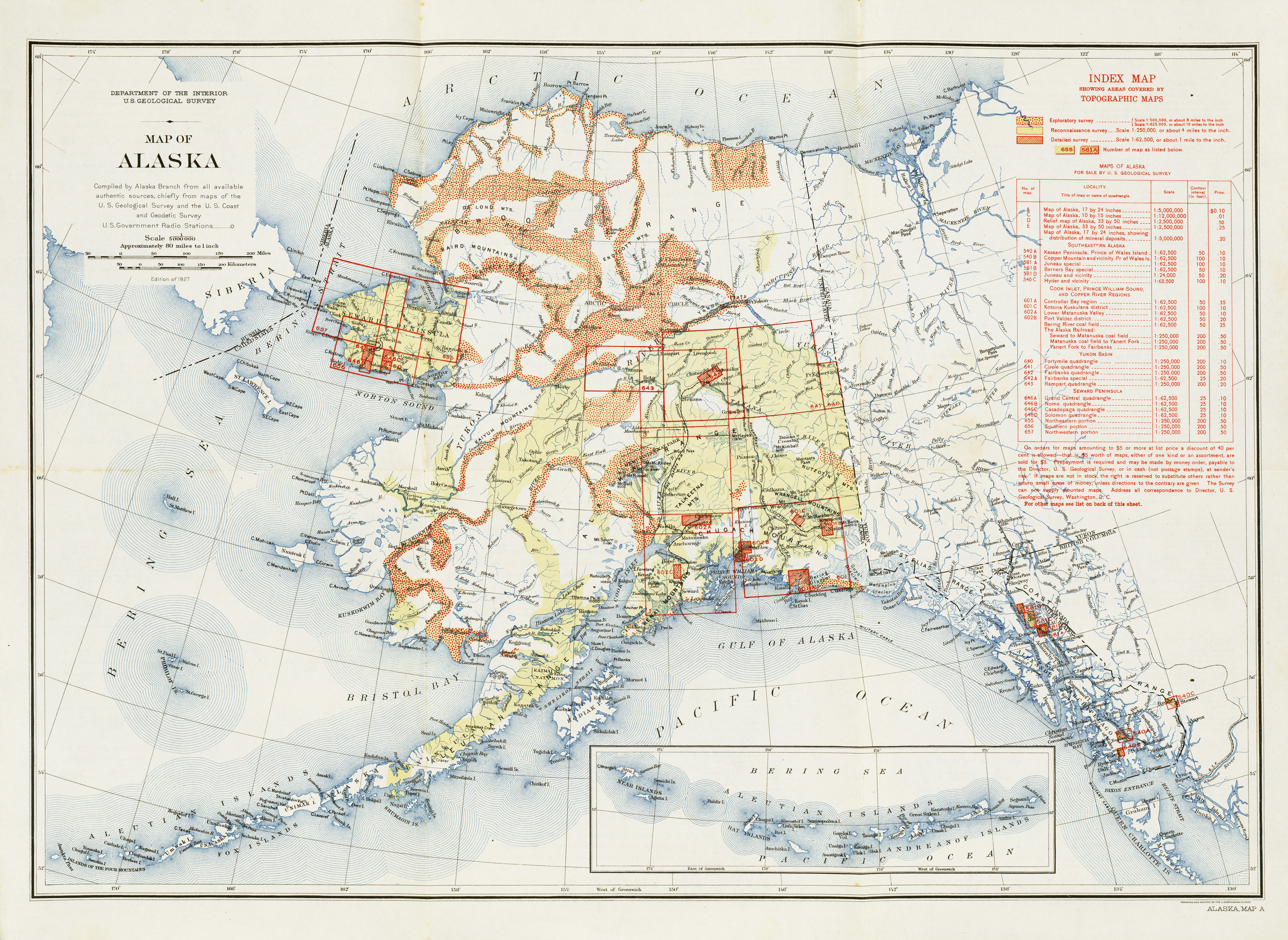
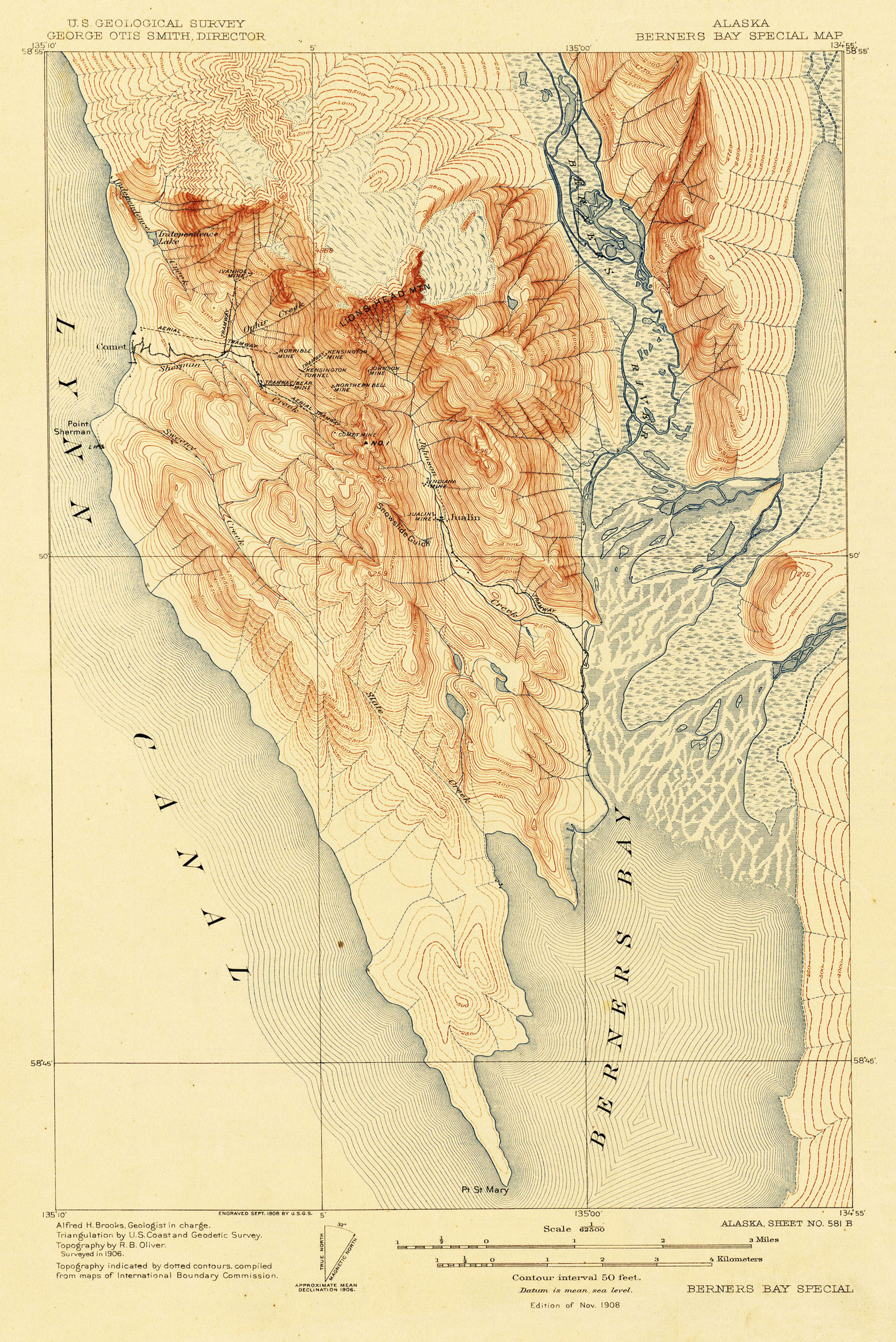
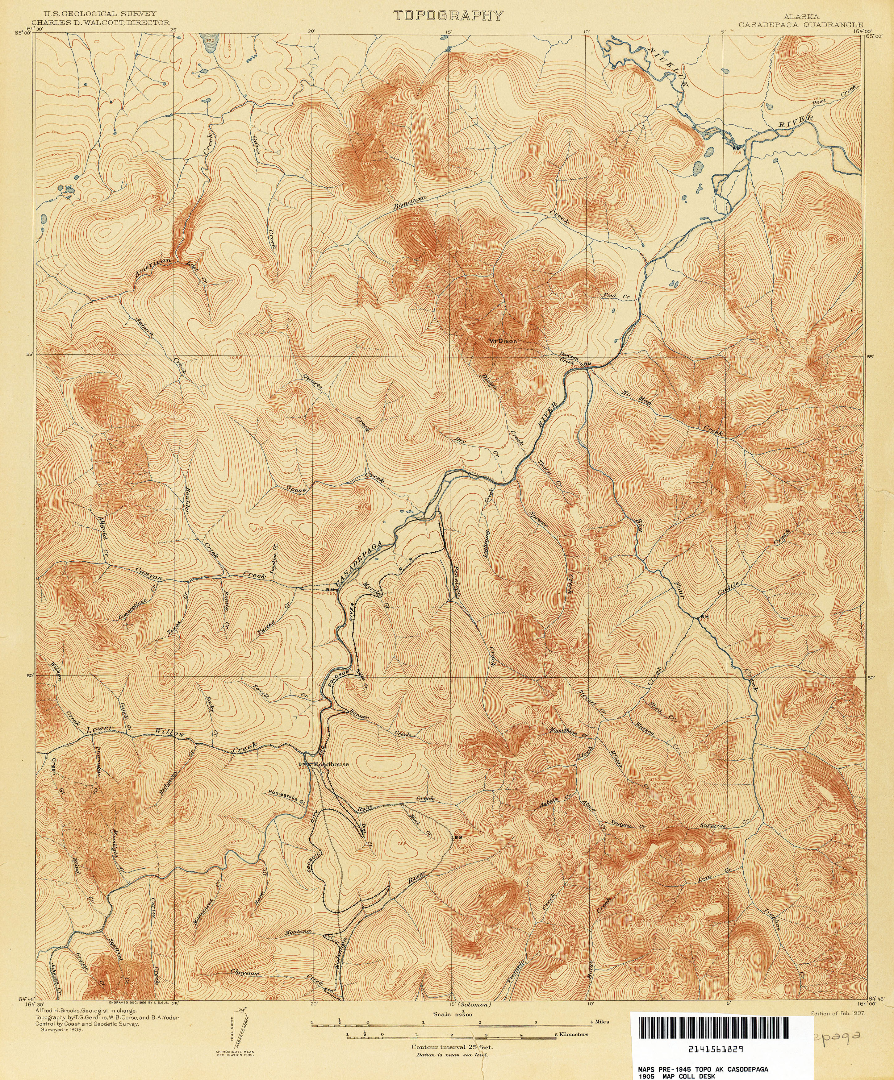
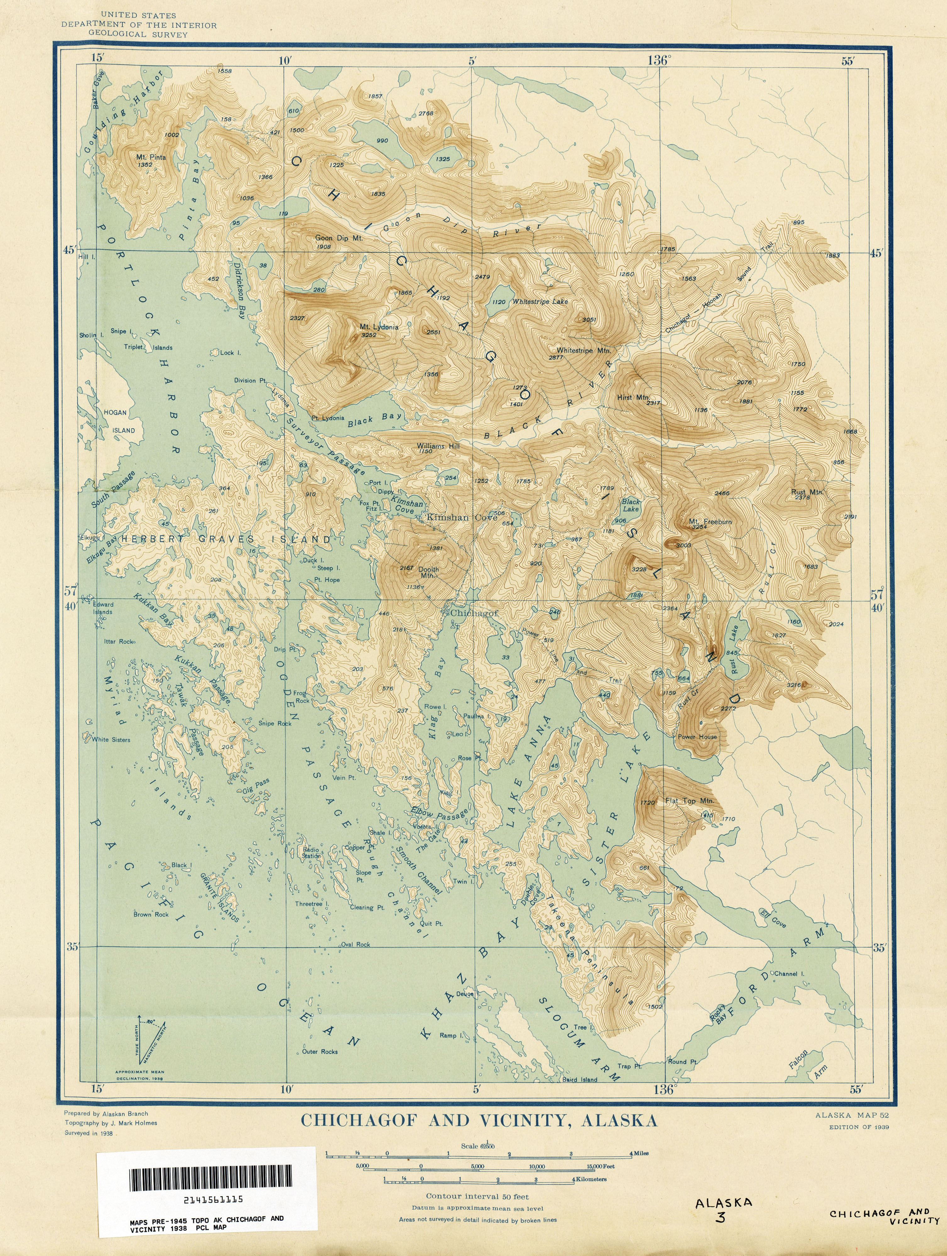
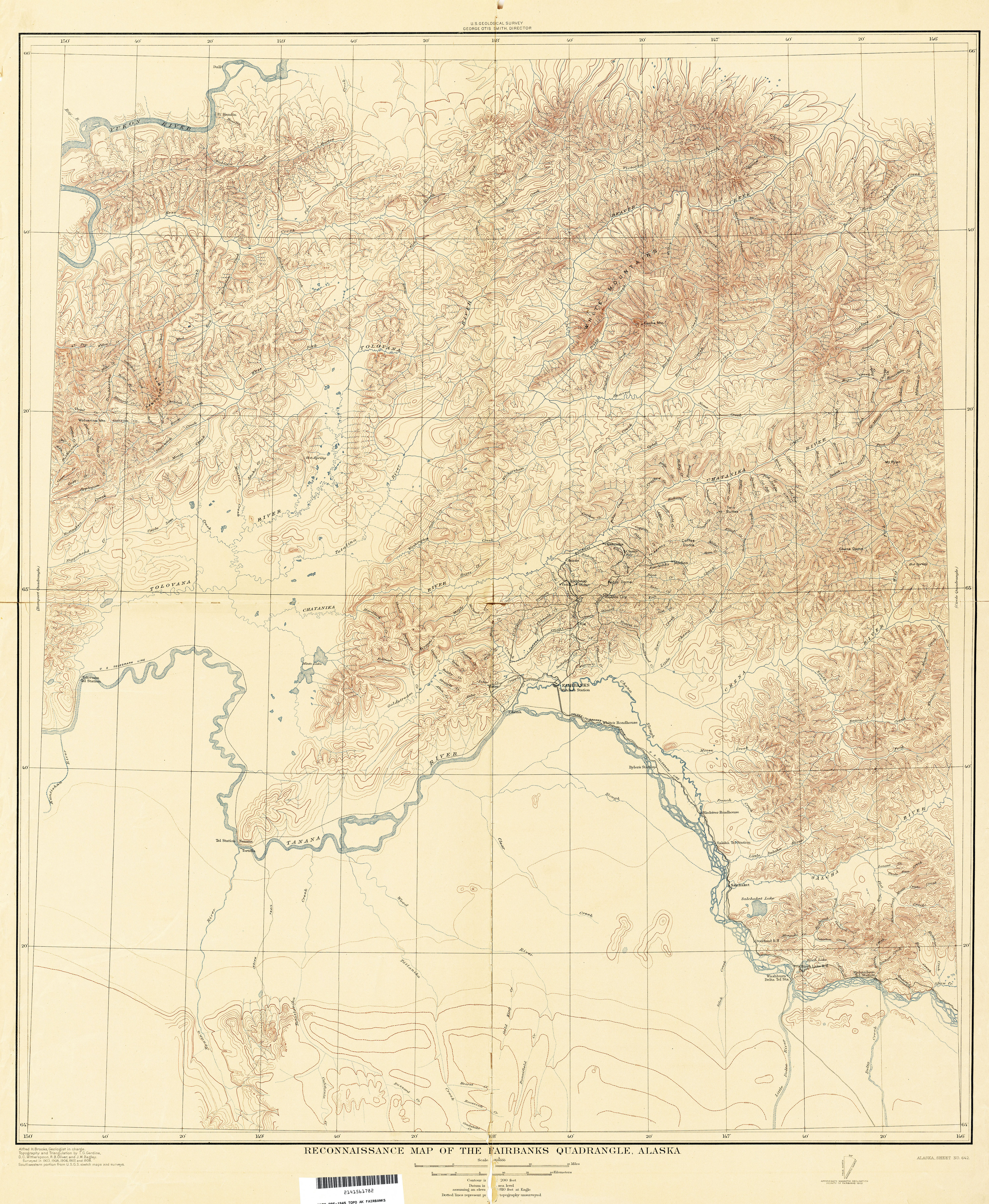
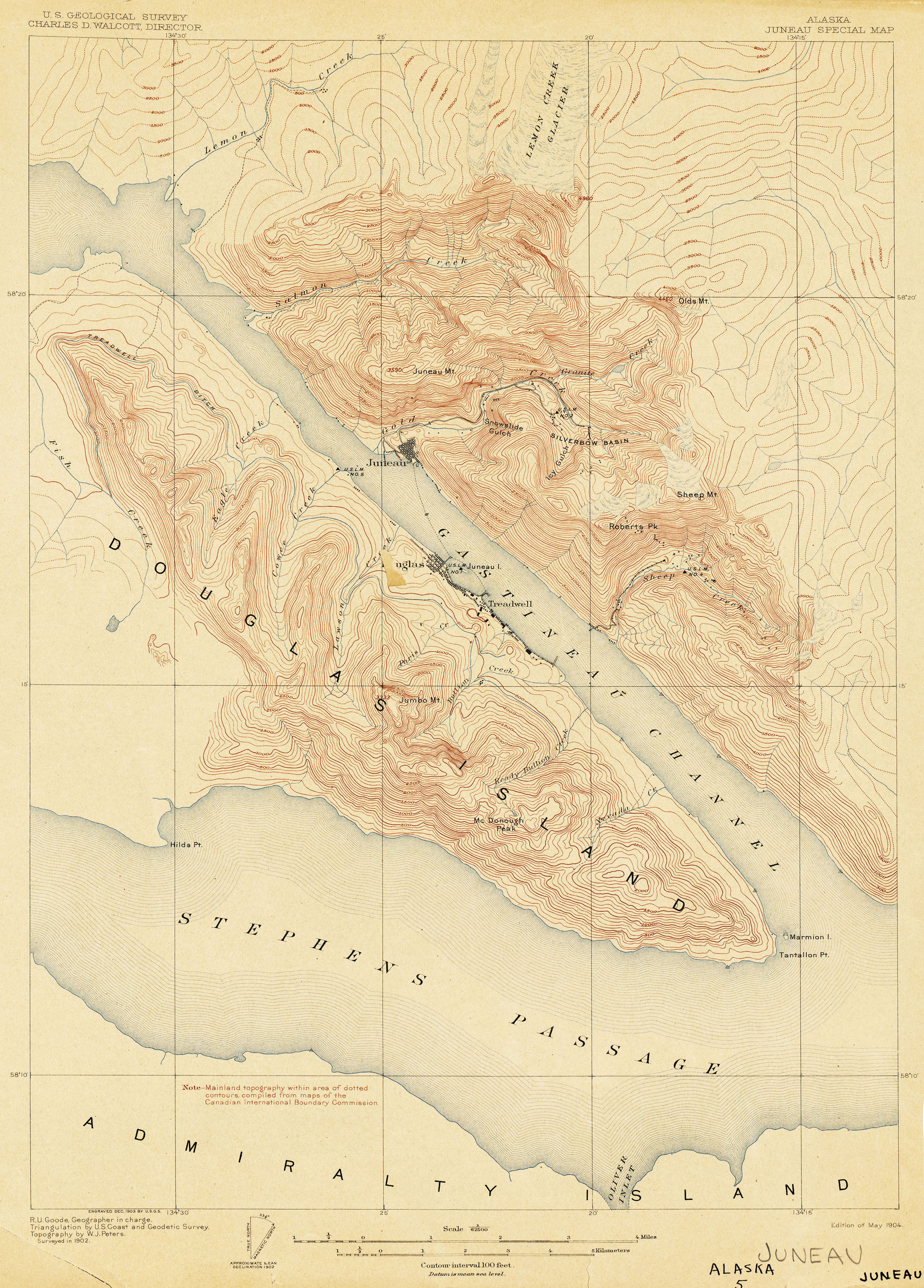
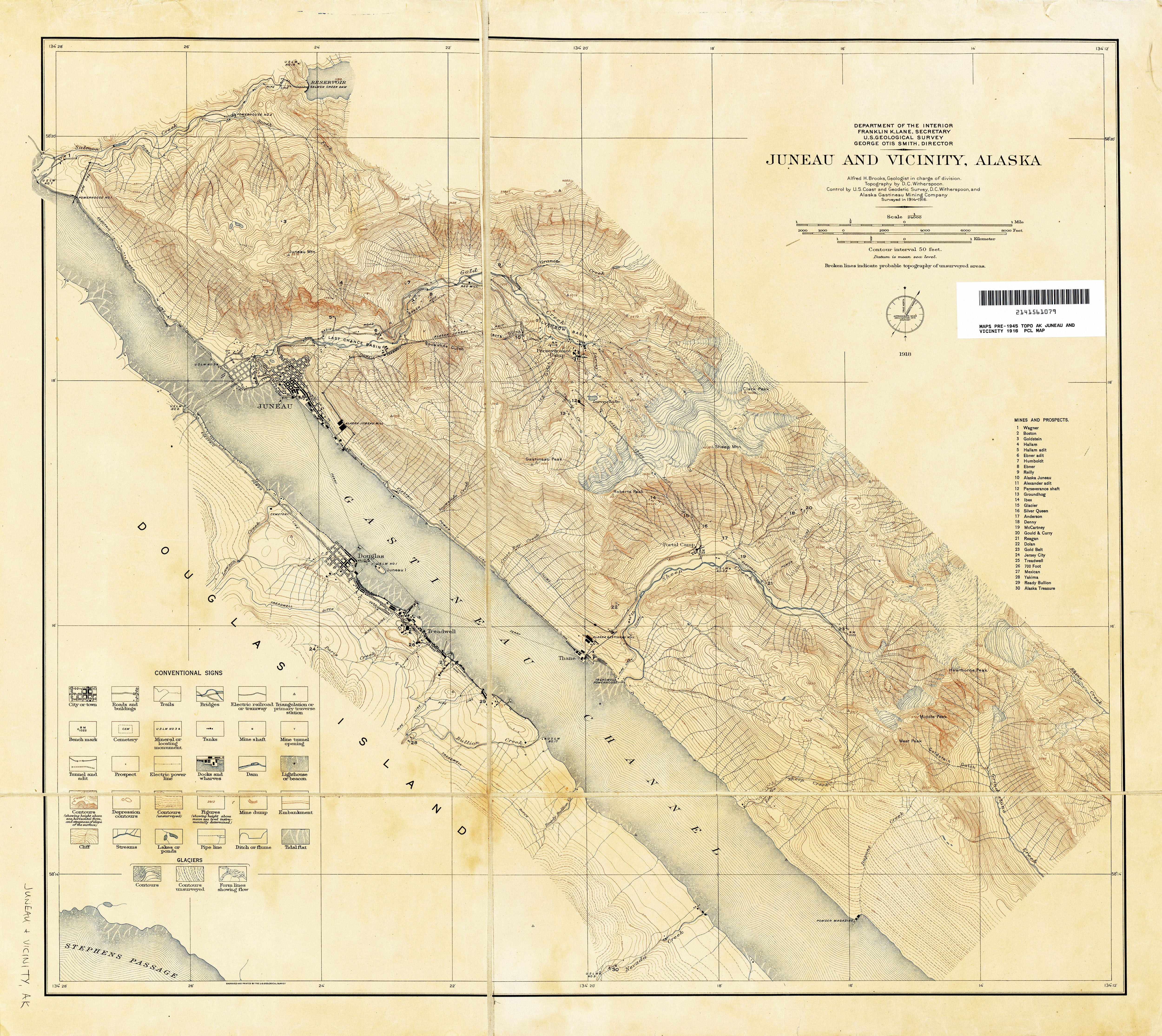
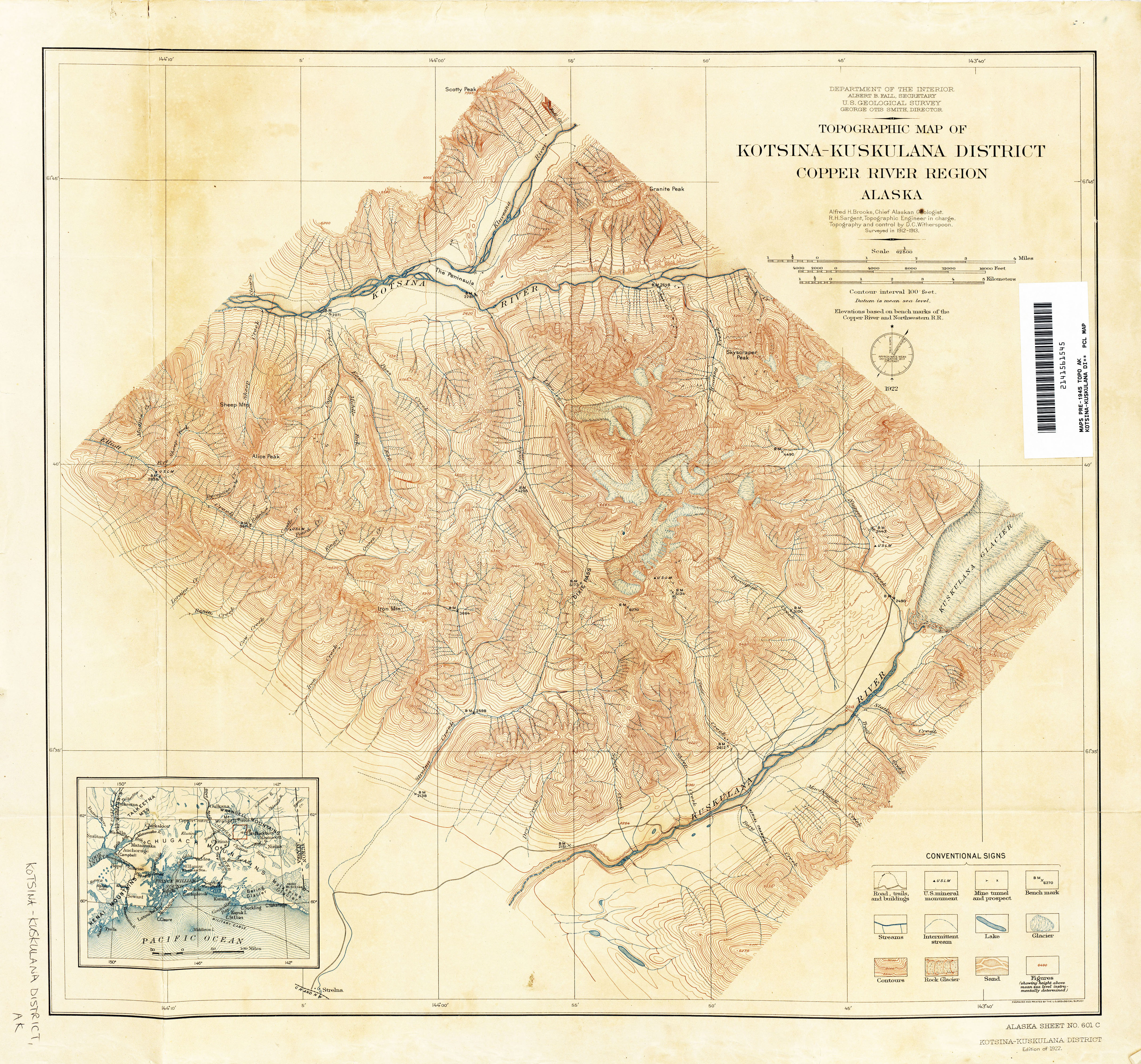
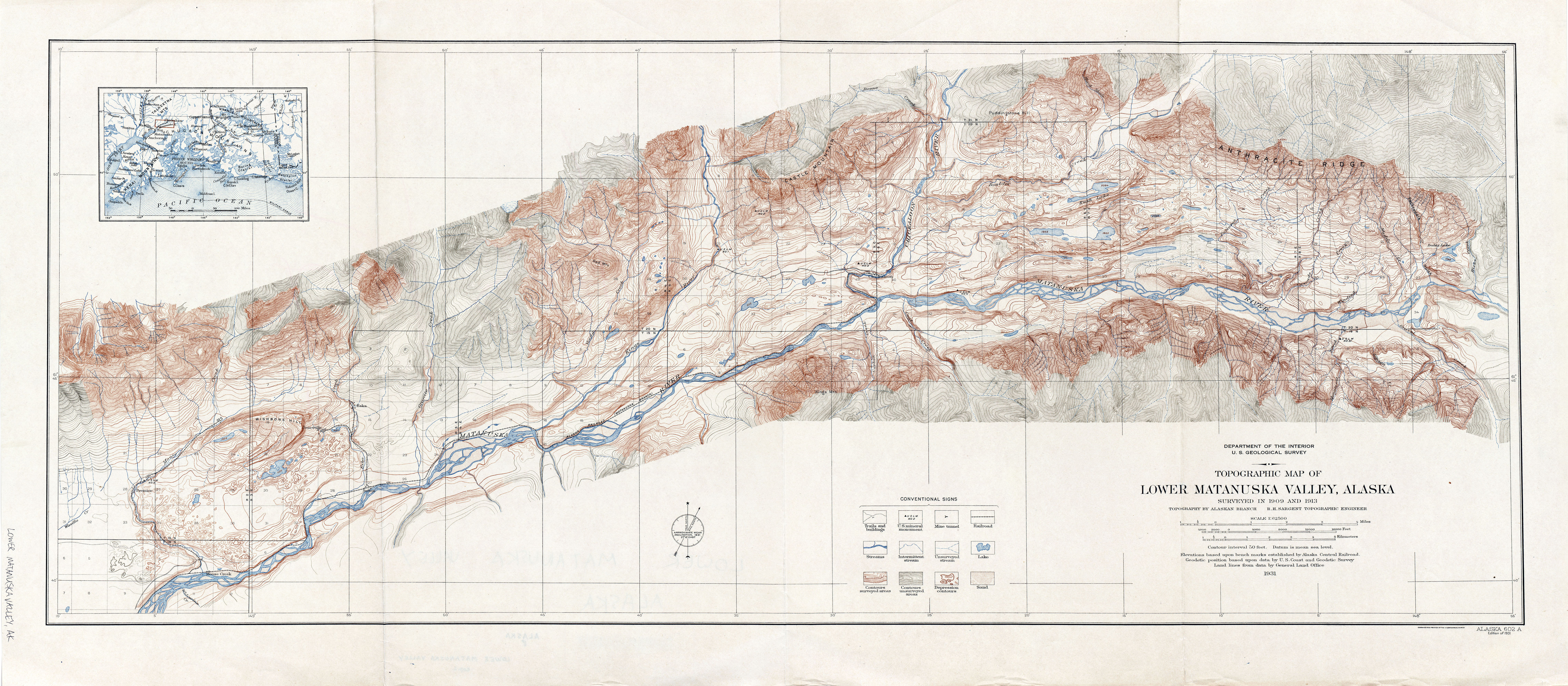
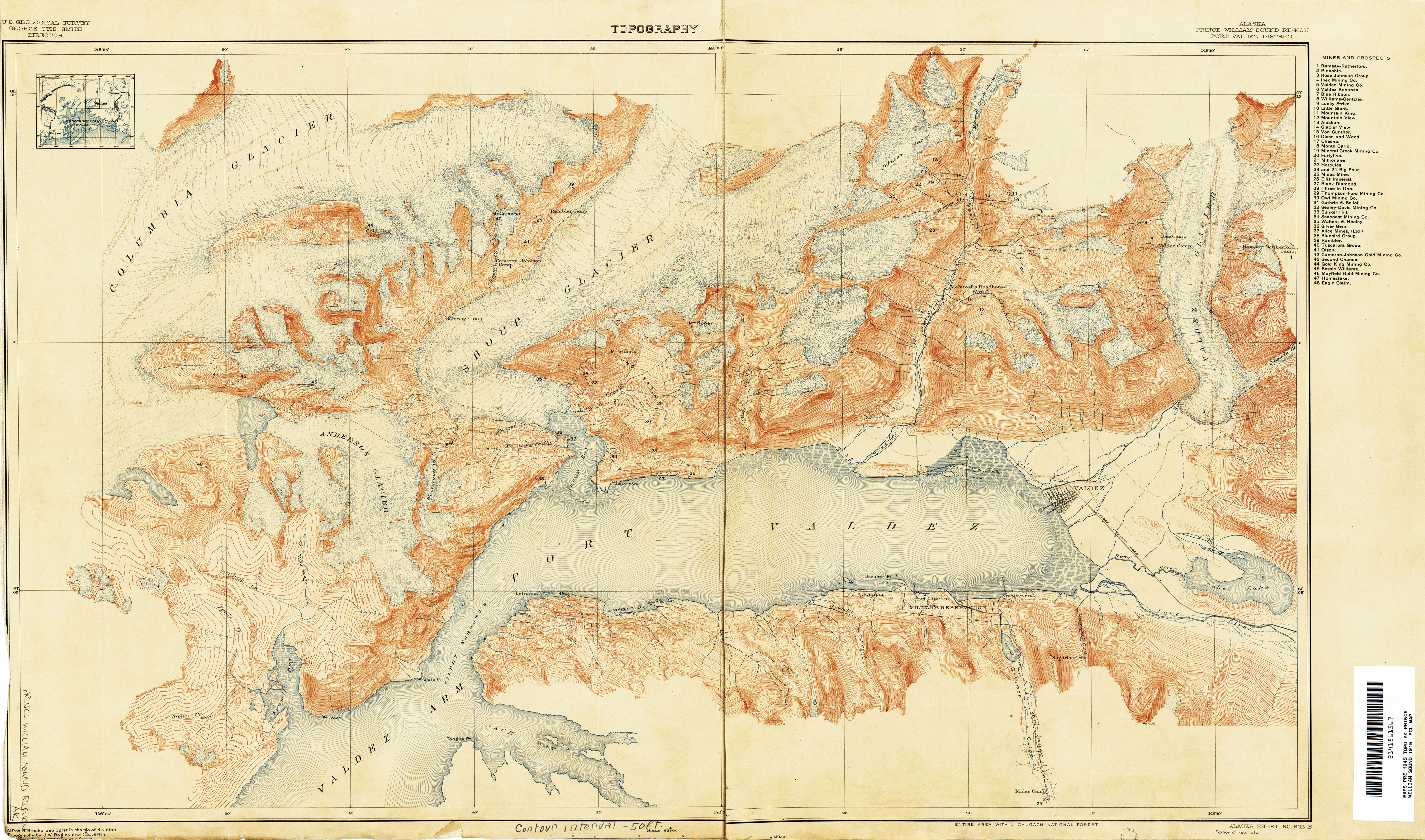
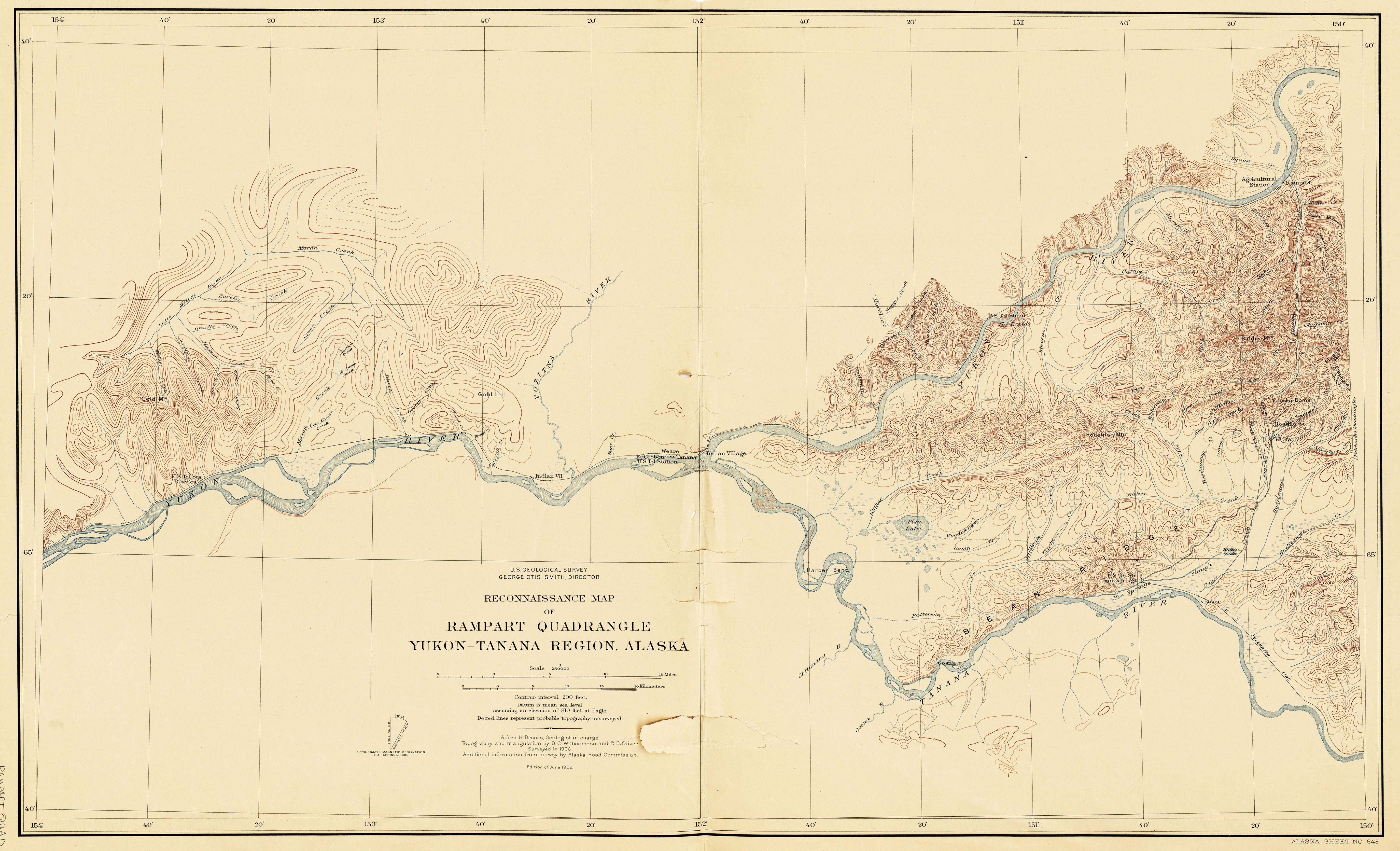
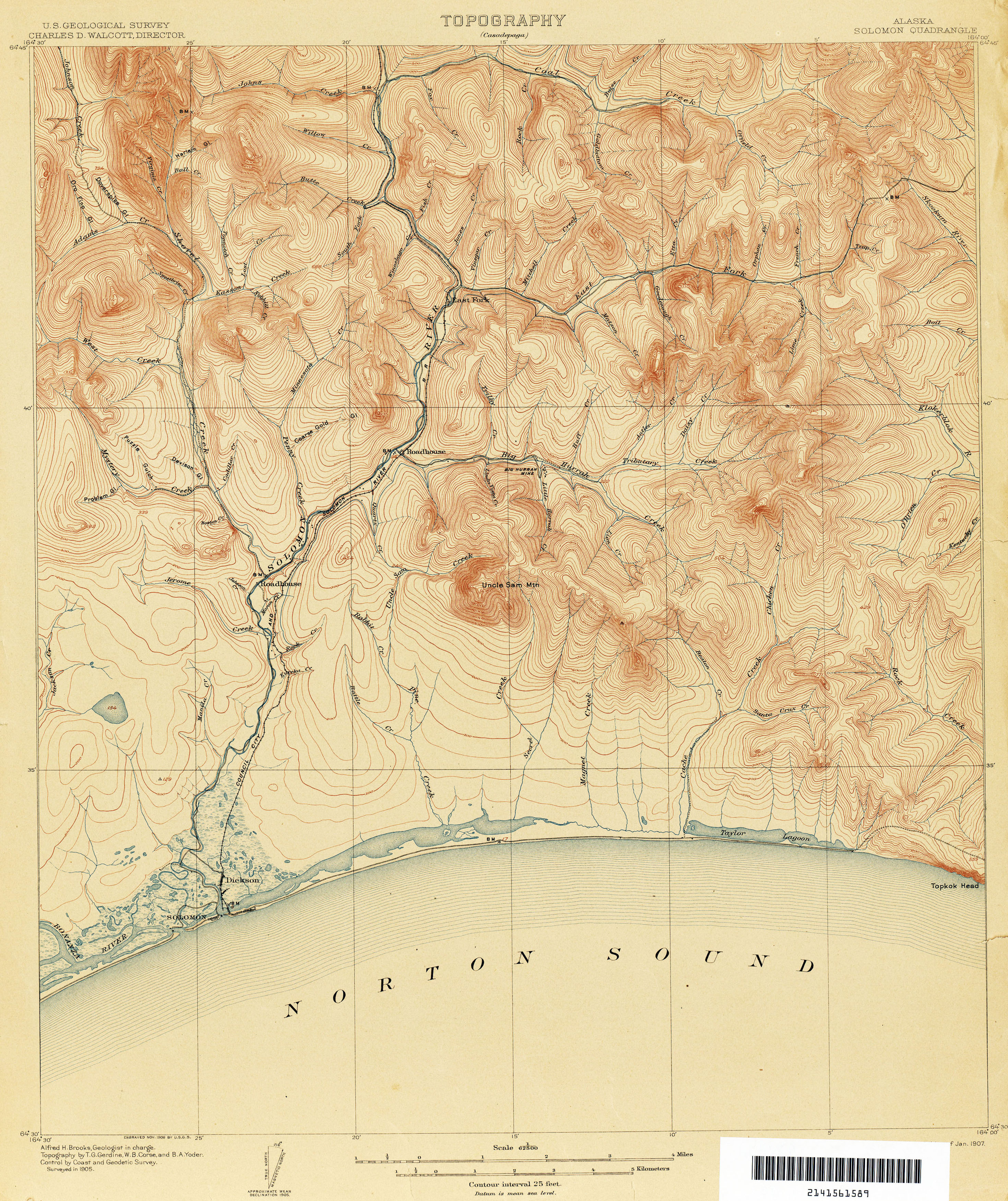
The USGS was entrusted with the responsibility for mapping the country in 1879 and has been the primary civilian mapping agency of the United States ever since. The best known USGS maps are the 1:24,000-scale topographic maps, also known as 7.5-minute quadrangles. From approximately 1947 to 1992, more than 55,000 7.5-minute maps were made to cover the 48 conterminous states. Similar maps at varying scales were produced during the same time period for Alaska, Hawaii, and US Territories. The 7.5-minute series was declared complete in 1992, and at that time was the only uniform map series that covered the United States in considerable detail.


64°00'00.0"N 150°00'00.0"W
Lieu: Alaska, USA
Publié: Février 2018
Catégorie: Cartographie
Lieu: Alaska, USA
Scales: 1:24’000 - 1:250’000
Collection: The University of Texas at Austin - Perry-Castañeda Library
Publié: Février 2018
Catégorie: Cartographie